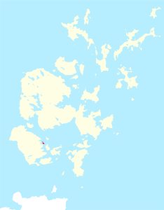
Rysa Little
| Rysa Little | |
|---|---|
| Waters | North Sea |
| Archipelago | Orkney |
| Geographical location | 58 ° 51 '36 " N , 3 ° 11' 45" W |
| surface | 32 ha |
| Highest elevation | 20 m |
| Residents | uninhabited |
Rysa Little is an uninhabited island in the archipelago of Orkney Islands. The area of the island is 32 hectares, the highest point is 20 meters above sea level. It is located in Scapa Flow , near the islands of Hoy and Cava . Between Rysa Little and the island of Fara there was massive self-sinking of interned German warships in 1919 . Today Rysa Little is uninhabited.
origin of the name
Rysa Little is old Norse and means something like "a pile of stones".
Web links
Commons : Rysa Little - collection of images, videos and audio files
