Faray
| Faray | |
|---|---|
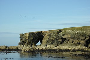
| The north end of Faray; at the transition dam to the Holm | |
| Waters | North Sea |
| Archipelago | Orkney Archipelago |
| Geographical location | 59 ° 13 ′ 0 ″ N , 2 ° 49 ′ 0 ″ W |
| surface | 1.8 km² |
| Highest elevation | 32 m |
| Residents | uninhabited |
| Ordnance Survey map sheet (1959) | |
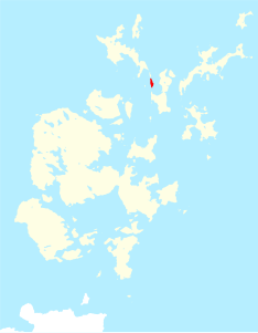
Faray (Old North. Faer-ey dt. Sheep Island; locally also Fara ) is a small island in the northern part of Orkney . Together with the island of Holm of Faray to the north, it marks the highest points of a land bridge between the islands of Eday and Westray , as it existed in the Neolithic . The island has an interesting coastline with geos, caves and a sandy beach at the south end.
Faray has been uninhabited since 1946. Both islands are still used seasonally as sheep pasture due to the grazing grounds. Several smaller archaeological monuments and the ruins of eight cottages bear witness to the former settlement.
At the southern end there are four well-preserved nausts (local nousts) with pointed ends. The largest is eight meters long and 2.3 meters wide. The Stalled Cairn on Faray, with some upright slabs in situ , is at the north end of the island, near the coast on the west side. He may have had "horns" on every corner, which indicates a heel-shaped cairn .
On the "Holm of Faray", a stone area on the southwest corner points to two Bronze Age houses. One is a large oval structure with radial partitions, like a wheelhouse . The Holm is a tidal island and is separated from Faray at high tide.


