Switha
| Switha | |
|---|---|
| Waters | Atlantic Ocean |
| Geographical location | 58 ° 47 '59 " N , 3 ° 6' 11" W |
| length | 1.4 km |
| width | 580 m |
| surface | 41 ha |
| Highest elevation | 28 m |
| Residents | uninhabited |
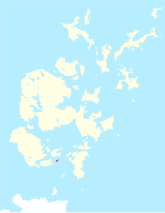
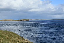
Switha is a small, uninhabited rocky island in the Scottish Orkney Archipelago , outside Scapa Flow Bay , south of Flotta Island and east of the South Walls Peninsula .
It has an area of 41 hectares and reaches its maximum height of 28 meters near the steep coast in the south. It is 1400 meters long and a maximum of 580 meters wide. It is used as grazing land for sheep. There is no record of whether the island was ever inhabited. However, two stone mounds and two menhirs ( English Standing Stones ) show that the island was visited in prehistoric times. Both menhirs are small, one about three feet high, 48 cm wide and 15 cm thick at the base; the other is about 1.4 m high, an average of 0.9 m wide and 12 cm thick and stands on a small hill. A hill on the island consists of several large stones. The archaeologist John Hunter believes one of them could be a fallen menhir.
Switha has many Petrel caves and wintering area for a colony of barnacle geese .
HMS Switha is the name of a target Isles class trawler that sank in 1981 .


