Farmington (New Mexico)
| Farmington | |
|---|---|
|
Location in New Mexico
|
|
| Basic data | |
| Foundation : | 1901 |
| State : | United States |
| State : | New Mexico |
| County : | San Juan County |
| Coordinates : | 36 ° 45 ′ N , 108 ° 11 ′ W |
| Time zone : | Mountain ( UTC − 7 / −6 ) |
|
Inhabitants : - Metropolitan Area : |
41,629 (as of 2016) 115,079 (as of 2016) |
| Population density : | 605.1 inhabitants per km 2 |
| Area : | 69.9 km 2 (approx. 27 mi 2 ) of which 68.8 km 2 (approx. 27 mi 2 ) is land |
| Height : | 1644 m |
| Postcodes : | 87401, 87402, 87499 |
| Area code : | +1 505 |
| FIPS : | 35-25800 |
| GNIS ID : | 0902246 |
| Website : | www.fmtn.org |
| Mayor : | William E. Standley |
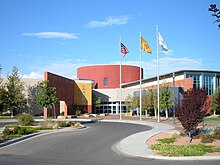
 Farmington City Hall |
|
Farmington is a city with 42,000 inhabitants (2016) in San Juan County in the state of New Mexico , USA . The urban area has a size of 69.9 km².
history
Spanish immigrants moved to what would later become San Juan County in the late 18th century, some of which later settled in the east. It was not until the middle of the 1870s that the population began to grow significantly and the "Farmingtown" settlement was created, which was later renamed Farmington. As a result, an agricultural economy developed in the place and the place was officially registered as a municipality in 1901.
At the beginning of the 20th century, the cultivation of apples in particular was an essential pillar of the economy in Farmington, before oil and natural gas production, which are still located there, were added later.
Farmington became known around the world when on March 17, 1950, three months before the outbreak of the Korean War , the largest alleged sighting of " flying saucers " in the United States was reported.
In the 1960s, the Four Corners power station was built nearby .
Historical objects
Farmington is home to the historic Farmington Historic Downtown Commercial District . The area includes 62 historic buildings, 8 blocks between Main Street and Broadway and between Auburn and Miller Avenues . The district was listed on December 20, 2002 by the National Register of Historic Places as a Historic Monument with the number 02001551.
Population development
| year | Residents¹ |
|---|---|
| 1980 | 31,222 |
| 1990 | 33,997 |
| 2000 | 37,844 |
| 2010 | 45,965 |
| 2016 | 41,629 |
¹ 1980-2010 : census results; 2016: Update of the US Census Bureau
climate
Farmington has an average of 273 days of sunshine a year. The long-term average temperatures are a maximum of 4.4 ° C (40 ° F ) in January, a minimum of −7.8 ° C, and a maximum of 32.8 ° C and a minimum of 15.6 ° C in July.
Individual evidence
- ↑ a b History. (No longer available online.) City of Farmington, archived from the original on October 6, 2010 ; accessed on June 7, 2009 . Info: The archive link was inserted automatically and has not yet been checked. Please check the original and archive link according to the instructions and then remove this notice.
- ↑ NRIS
- ↑ Fast Facts. (No longer available online.) Farmington Chamber of Commerce, archived from the original on June 14, 2009 ; accessed on June 7, 2009 . Info: The archive link was inserted automatically and has not yet been checked. Please check the original and archive link according to the instructions and then remove this notice.

