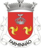
Farminhão
| Farminhão | ||||||
|---|---|---|---|---|---|---|
|
||||||
| Basic data | ||||||
| Region : | Centro | |||||
| Sub-region : | Dão-Lafoes | |||||
| District : | Viseu | |||||
| Concelho : | Viseu | |||||
| Coordinates : | 40 ° 37 ′ N , 8 ° 1 ′ W | |||||
| Residents: | 750 (as of June 30, 2011) | |||||
| Surface: | 10.97 km² (as of January 1, 2010) | |||||
| Population density : | 68 inhabitants per km² | |||||
Farminhão is a former municipality ( freguesia ) in the Portuguese district of Viseu . 750 inhabitants live in it (as of June 30, 2011).
history
The place emerged during the Reconquista after the 8th century. In the royal surveys of 1258 it was run as a separate municipality. It remained a parish of the São Miguel do Outeiro district until its dissolution in 1855. Since then, Farminhão has been a parish of the Viseu district.
On September 29, 2013, the municipality of Farminhão was merged with the municipalities of Boa Aldeia and Torredeita to form the new municipality of União das Freguesias de Boa Aldeia, Farminhão e Torredeita as part of the administrative reorganization . Torredeita became the headquarters of the new municipality.
Sons and daughters of the church
- António Amaral Leitão ( Capitão Leitão , 1945–1903), officer, republican activist
- António Gonçalves da Costa (1887–1983), former pastor, then agricultural entrepreneur and educator
- Fernando de Carvalho Ruas (* 1949), long-time mayor of Viseu, MEP since 2014
Individual evidence
- ↑ a b www.ine.pt - indicator resident population by place of residence and sex; Decennial in the database of the Instituto Nacional de Estatística
- ↑ Overview of code assignments from Freguesias on epp.eurostat.ec.europa.eu
- ↑ Profile of the municipality of Farminhão ( Memento of the original from June 1, 2014 in the Internet Archive ) Info: The archive link was inserted automatically and has not yet been checked. Please check the original and archive link according to the instructions and then remove this notice. at www.retratoserecantos.pt, accessed June 1, 2014
- ^ Publication of the administrative reorganization in the Diário da República gazette of January 28, 2013, accessed on May 31, 2014


