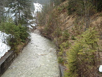
Fischbach (Linder)
| Fischbach | ||
|
Fischbach on the state border |
||
| Data | ||
| Water code | EN : 166 | |
| location |
Upper Bavaria , Swabia (Germany), Reutte District (Austria) |
|
| River system | Danube | |
| Drain over | Linder → Ammer → Amper → Isar → Danube → Black Sea | |
| origin | Confluence of Weidentalbach and Rückentalbach 47 ° 32 ′ 49 ″ N , 10 ° 52 ′ 41 ″ E |
|
| Source height | 1260 m above sea level NHN | |
| confluence | with the Neualmbach to Linder Coordinates: 47 ° 32 '14 " N , 10 ° 53' 24" E 47 ° 32 '14 " N , 10 ° 53' 24" E |
|
| Mouth height | approx. 1090 m above sea level NHN | |
| Height difference | approx. 170 m | |
| Bottom slope | approx. 56 ‰ | |
| length | 3.1 km (with Weidentalbach ) | |
|
Fischbach entering the Neualmgries |
||
The Fischbach is the left source brook of the Linder in the Ammergau Alps , southwest of Oberammergau in Bavaria and Tyrol .
course
The Fischbach is created by the confluence of the Weidentalbach and Rückentalbach on the border between Swabia and Upper Bavaria . The Weidentalbach is the main source stream and has its source at the Schlössel (1843 m). The Rückentalbach flowing down from the Scheinbergspitz (1929 m) joins it south of the Weidentalalpe to form the Fischbach . This initially flows south, meets the national border with Austria and bends as a border stream to the east. After a few hundred meters it joins the Neualmbach to the Linder .
Water code
The river code DE: 166 carries the water from Weidentalbach via Fischbach , Linder , Ammer to the confluence of the Amper into the Isar .
Web links
Individual evidence
- ^ Bayernviewer of the Bavarian Surveying Administration
- ↑ GeoFachDatenAtlas and water services of the Bavarian State Office for the Environment

