
Fractional series
|
Fractional line Frauenbach, Frohbeek |
||
 Upper course in the Vor dem Bruche building area in Harlingerode |
||
| Data | ||
| location | Lower Saxony , Germany | |
| River system | Weser | |
| Drain over | Hurlebach → Oker → Aller → Weser → North Sea | |
| source | Harlingeröder Bruch near Schlewecke 51 ° 54 ′ 9 ″ N , 10 ° 31 ′ 48 ″ E |
|
| Source height | 222 m above sea level NHN | |
| muzzle | north of Harlingerode in the Hurlebach Coordinates: 51 ° 54 ′ 46 " N , 10 ° 31 ′ 12" E 51 ° 54 ′ 46 " N , 10 ° 31 ′ 12" E |
|
| Mouth height | 189 m above sea level NHN | |
| Height difference | 33 m | |
| Bottom slope | approx. 21 ‰ | |
| length | about 1.6 km | |
| Medium-sized cities | Bad Harzburg | |
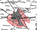
The Bruchlinie [ ˈbʁuːχˌʁaɪ̯ə ] is an orographically right tributary of the Hurlebach in the Bad Harzburg district of Harlingerode .
history
The name Bruchzeile refers to its function as a drainage ditch for the Harlingeröder Bruch, which was a swamp area until modern times. Another name of the brook is Frauenbach (Low German: Frohbeek ).
In the course of the 20th century the village degraded the brook to a trickle. After the construction of the Harlingeröder elementary school, the row of ruptures was therefore piped around 1960 to make room for a footpath. the former culvert through the Oker – Bad Harzburg railway line has been converted into a pedestrian passage. The resulting path was nicknamed the “Messeschnellweg” because it was used for all kinds of errands by the residents over time. In Harlingerode, the street Am Frohbeek was named after the brook.
A section of the piping was exposed in the new building area Vor dem Bruche in the 2000s to enable the inlet of a rainwater retention basin.
course
Of its roughly 1.3 kilometers long, historically documented course, only about 40 meters are exposed. These are located immediately south of the highway and west of the rainwater retention basin. The stream is located and straightened in a bed about one meter deep. After entering the piping, the series of breaks runs below the local north-south footpath and flows into the Hurlebach below Worthstrasse.
photos

First exit to the surface
The historic Frobeek in 1910


literature
- Wilhelm Baumgarten : Contributed to: The larger Bad Harzburg . P. 42.
Web links
Individual evidence
- ↑ a b c Lower Saxony state survey: Topographic map 1: 50,000 Lower Saxony / Bremen , status 2000
- ↑ R. Wieries: The names of the mountains, cliffs, valleys, springs, watercourses, ponds, localities, farm districts, forest locations and paths in the Harzburg district court . In: Landesverein für Heimatschutz in the Duchy of Braunschweig (ed.): The field names of the Duchy of Braunschweig . tape 1 . E. Appelhans & Comp. GmbH, Braunschweig 1910, p. 90 ( PDF file on the TU Braunschweig publication server ).
- ^ A b LGLN : Map of the state of Braunschweig in the 18th century, sheet BL4029_4129 Vienenburg / Bad Harzburg
- ↑ Jürgen Spönemann: Geographical Land Survey: The natural spatial units on sheet 100 Halberstadt. Federal Institute for Regional Studies, Bad Godesberg 1970. → Online map (PDF; 4.7 MB)