
Harlingerode
|
Harlingerode
City of Bad Harzburg
|
|
|---|---|
 |
|
| Height : | 212 (190-251) m above sea level NN |
| Area : | 11.32 km² |
| Residents : | 2918 (Dec. 31, 2019) |
| Population density : | 258 inhabitants / km² |
| Incorporation : | July 1, 1972 |
| Postcodes : | 38667, 38644 |
| Area code : | 05322 |
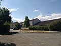
 Harlingerode in Bad Harzburg
|
|
 Map of the local area
|
|
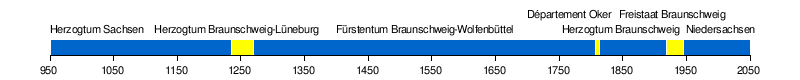
Harlingerode [ ˈhaʁ.lɪŋɘˌʁoːdɘ ] (from Old Saxon Herlingeroth ; traditionally Harlingerode am Harz , Oker dialect Haljerue ) is a district of Bad Harzburg in the district of Goslar in Lower Saxony , Germany and 4 km northwest of the core area of Bad Harzburg. With 2,918 inhabitants (as of December 31, 2019), it is the third largest town in the city after the city center and Bündheim .
Harlingerode can look back on more than a thousand years of history. The construction of the zinc smelter in Harlingerode and the founding of Göttingerode in the 1930s as well as the Europa- aurus finds at the Langenberg limestone quarry are of historical importance . With the law on the reorganization of the communities in the Harz region , it was incorporated into the city of Bad Harzburg on July 1, 1972, and at the same time the area was separated from the Wolfenbüttel district and added to the Goslar district.
geography

location
Harlingerode is located northwest of the city center at an altitude of between 190 m above sea level. NHN and 250 m above sea level NHN on the steep slope of the Langenberg , a Mesozoic limestone hill. The district is between 170 m above sea level. NHN ( Okertal south of Vienenburg ) and 304 m above sea level. NHN (Franzosenkopf, Langenberg) high.
Neighboring places
| Immenrode , Probsteiburg | Vienenburg | Lochtum , Bettingerode , Gut Radau |
| Goslar (city center, Sudmerberg ) |
.svg)
|
Westerode , Radauanger |
| Oker | Göttingerode | Bad Harzburg ( Schlewecke , Bündheim ) |
Division of space

after 950 years of Harlingerode , as of 2000.
geology

The Harlingeröder soils have been explored very well thanks to the direct length of the north Harz edge fault. The place is not far from the southern edge of the North German Plain , which is noticeable here in the rather sharp transition from tertiary to Mesozoic layers of earth towards Langenberg. The soils rejuvenate significantly from south to north: If the northern steep slope of the mountain comes from the White Jura , the age in southern Oberharlingerode shifts to the Lower Cretaceous and is occupied by tertiary layers from around the level of the Landstrasse.
In the north, the village goes up to 190 m above sea level. NHN into the Wiederöder Berge, a loess plain between the river valleys of the Oker and the Radau that is intensively used for agriculture. Nowadays wheat is grown here , but until the 1950s, oats were mainly grown.
The Wiederöder Mountains are very clearly demarcated from the Oker valley to the west. This is dominated by gravel deposits and therefore generally referred to as a stone field . There is also a clear drop to the east from the Wiederöder Mountains, here the plateau merges into the Radau Wood in the northeast and into the Radau valley dominated by gravel ponds at Gut Radau to the east .
Waters
.jpg)
The Hurlebach is the central flowing water in Harlingerode. The stream on the Langenberg has its source on the former Hansa mine . In the local area, the brook runs underground and takes in several tributaries, so-called Strüllecken , from the south (example: Bruchlinie ). The Hurlebach leaves the village in the northeast and flows into the Oker in Vienenburg .
The Teufelsbach rises northeast of Harlingerode in the Bad Harzburg-Nord industrial area. It flows northeast into the Radauer Holz and flows into the Radau beyond the Feldmark .
In the extreme northwest, the Oker flows near Probsteiburg . Here it forms the border to the Feldmark of Immenrode . With the Okertal south of Vienenburg, there is also a lake landscape here, formed by gravel mining in the area known as Steinfeld .
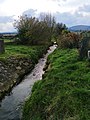
The Hurlebach

The fracture series

The Teufelsbach


history
Affiliation with Harlingerode
Place name
In the first mention of 1053 the place is called Heregeltingeroth. Further mentions of the place are:
- 1057/1181: Herlingerode
- 1195: Herlincherode
- circa 1320: Harlyngerode
- 1654: Harlingeroda
The name Harlingerode is traced back to a name Herilo ; this in turn is related to Old High German hari with the meaning "army". One can therefore assume that the name has a meaning "hero, fighter, army". The ending -ingerode is typical of the old Saxon clearing settlements of the High Middle Ages on the northern Harz.
Founding saga
A founding legend in the village that was widespread up into the 19th century relates to a deserted area called Harlierode : The residents of this village gave up their old home halfway to Wöltingerode and founded their new settlement Heregeltingeroth further south. Since Harlingerode has been a Vorwerk of the Goslar Cathedral Foundation since 1053 and the ending -ingerode suggests that it was founded no more than 150 years earlier, it would have to be a very old desert, which would also have the same name as today's Harlingerode. The local historian Hilmar von Strombeck went even further in 1873 and, if this theory is true, interpreted that "Neu-Harlingerode" also includes the population of Jettgerode / Göttingerode , which had also previously disappeared :
"The legend says that the village that stood here was called Harlierode, and that after entering the same and from Jettgerode the inhabitants of both villages built on the site of the current Harlingerode [...]"
The problem here is that Göttingerode was only mentioned after Harlingerode and there is also evidence of the existence of the old settlement until the 15th century. Nowadays one can consider this legend as unsecured and in the mentioned desert one can consider the independently fallen desert Wenderode . An even more daring approach from the end of the 19th century was based on a reference to the East Germanic tribe of the Heruli , which can be practically ruled out due to the enormous temporal and spatial distance.
Desolation
The old Harlingeröder Feldmark is rich in desertification from the early and high Middle Ages on its approx. 13 square kilometers. For most of them, the exact location is unclear due to a lack of research, but a location in the field mark is likely:
- Düringerode - to be located north of the Oker and the Feldmark, fell into desolation after 1355
- Göttingerode - south of the Langenberg, fell into desolation after 1468, re-founded in 1935
- Hilwerdingerode - in the north or northeast, belonging to the Wöltingerode monastery ; after 1463 it fell desolate
- Isingerode - probably in the north, less likely in the west of the Feldmark, fell into desolation in the 12th or 13th century. Identity with Wenderode possible
- Wenderode - to be located in the north of the Feldmark, fell into desolation in the 12th or 13th century. Identity with Isingerode possible
Local history
Early history
Harlingerode was laid out in the 10th century by the Saxon noble family of Billunger . They had this place until 1053, when Count Tiemo ( Thietmar von Sachsen ) as a result of a conflict with Heinrich III. exiled and all of his property confiscated. Henry III. issued a deed of donation to the Goslar cathedral monastery on June 3, 1053 , with which the place finds its first historical record . Pope Viktor II confirmed ownership to the cathedral monastery in 1057 and named the estate Herlingerode .
In the following 150 years, the Goslar cathedral monastery expanded the village into one of its 11 main courtyards. The main courtyard was located in what is now the street ring Brunnenstrasse - Viehweide - Meinigstrasse on the Kirchbrink, west of today's St. Marien Church, and is the nucleus of the early development of the town. For the year 1181, 10 other courtyards are named for Harlingerode in addition to the main courtyard. After the cathedral monastery gave up the system of main courtyards around 1200, the courtyards in Harlingerode split into three large courtyards, and this development continued into the 16th century. The first pastor was named in a document in 1346, so there must have been a church at that time, probably only a chapel .
The late Middle Ages in the Harlingerode area was marked by a period of strong desertification, all of which affected cleared areas. The influence on the Harlingeröder Feldmark, however, remained marginal.
Modern times to World War II
During the Thirty Years War , Harlingerode was burned down together with Schlewecke at the end of 1625 . The recently built St. Mary's Church also fell victim to the flames. The church in its current form was consecrated in October 1750 and received a steeple in 1794/95 . The cathedral monastery, which still owned the Harlingeröder Bruch in the middle of the 18th century and, as a landlord, over most of the local farms, was dissolved at the beginning of the 19th century. The Harlingeröder cemetery on Rupenklint was inaugurated on November 18, 1854.
Until the middle of the 19th century, Harlingerode remained a pure farming village, the residents of which lived mainly from agriculture and handicrafts. A first step towards industrialization was initiated by Wilhelm Castendyck , who found profitable ore deposits on Langenberg in 1857 and thereby founded the Hansa mine on Langenberg in 1861 . Until it was closed in 1960, it produced around three million tons of ore with interruptions. Another advance in the 19th century was the establishment of a postal agency in 1880.
Through a state treaty between the Duchy of Braunschweig and Prussia , Harlingerode received around 4.5 km² of area north of Alte Goslarschen Strasse from the Vienenburg district in 1905 . In 1910 the local fire department was founded. On May 1, 1912, the Bad Harzburg – Oker railway went into operation, so that the Harlingerode station was officially opened on the same day .
In the 1930s, Bundesstraße 6 ( Landstraße ) was downgraded to a district road after the new building via Bündheim and Göttingerode was completed.
The SPD maintained itself as a stable political force both during the Weimar Republic and in the early days of the Third Reich : It won almost 50% of the votes in the last scheduled municipal council election in 1931, and the party also won the Reichstag election in March 1933 around 47% compared to the NSDAP with 38%.
After the " seizure of power " by the National Socialists, extensive economic investments began in the local area. In 1935, the National Socialist model settlement of Göttingerode was founded south of Langenberg and the Harlingerode zinc smelter to the west of the Kaltes Feld district , which was the most modern of its kind in Germany until the 1970s. As a result of the Rammelsberg project in 1936/37, 618 people were employed in it, around 200 of whom lived as forced laborers in a barrack camp south of today's highway towards Oker.
The cable car from the Hansa mine to the Mathildenhütte was dismantled on May 20, 1943 and rebuilt in Konin in what is now the Greater Poland Voivodeship .
On the evening of April 10, 1945, units of the 329th Regiment of the 9th US Army from Oker arrived in Harlingerode after they had already taken Goslar; they then moved further east to Bad Harzburg.
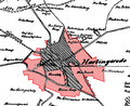
Local area in 1910, today's area colored in red

Hunt of the Hansa mine in Göttingerode


post war period
The American occupiers appointed Friedrich Bäsecke, who had already held the position in 1933, as acting mayor.
The first session of the community council after World War II was held on December 2, 1945 after the members were appointed by the military government. There was a dispute within the local SPD association, which led to an unstable situation for the mayor in the first few years; Until Wilhelm Baumgarten was elected , four mayors ruled within seven years.
After the end of the Second World War, a strong influx of expellees mainly from Silesia began in Harlingerode. In order to cope with the situation, the Steinfeld refugee camp with a planned capacity of 250 people was set up on the Vienenburg – Goslar railway not far from the Düringerode desert . The community of Harlingerode rejected a permanent construction as a settlement due to the great distance to the main town. The increase in population also benefited the domestic industry, which had a high demand for workers and was able to fall back on skilled workers (example: Silesian miners in the service of the Hansa mine).
The growing coal and steel industry posed a problem in the 1950s. As a result of the Korean War , production at the Harlingerode zinc smelter increased considerably from the early 1950s, so that the strong lead and sulfur dioxide emissions caused considerable damage to the vegetation. The damage was so severe that at the beginning of the 1960s, several local politicians founded the “Society for Landscape Management in the Harzburg District ”. A landscape and garden architect from Hildesheim, Dr. Foreman, about 100 pages long “Landscape plan for the Harzburg district” documented the situation.
In November 1960 the municipal administration moved from the previous building in the Viehweide to Landstrasse 26. The building in Oberharlingerode has a contemporary architecture, the location was chosen together with a footpath between Steile Weg and Göttingeröder Straße in favor of accessibility from Göttingerode. The Hansa / Hermann mine, which has now been exhausted and has only been operated in expansion construction for the past few decades , was closed on August 23, 1960. On January 1, 1962, a social contract came into force for the renaturation of the Langenberg, which provided for the afforestation of deserted and devastated areas, the planting of windbreaks, tree planting on paths and watercourses and the construction of hiking trails in the period up to 1975.
Between 1963 and 1966, a wastewater sewer system was built in Harlingerode at great expense, and its wastewater was recycled in the newly built Steinfeld sewage treatment plant.
On October 14, 1970 the construction of the village community center (today's leisure center) was approved and inaugurated on June 2, 1972 with an opening ceremony. Kurt Partzsch , former Lower Saxony Minister of Social Affairs, gave the opening speech. Structural change progressed in Harlingerode in the 1970s , for example the Harlingerode zinc smelter reduced its capacities in the wake of the oil crisis in the mid-1970s and the Klages sawmill closed in September 1972 due to bankruptcy. Regular passenger service at Harlingerode station ended in 1974.
Various new construction projects were tackled from the 1950s to provide living space:
- 1953: In the night house + side streets
- 1957: Am Pfuhle, Josefstrasse / Krautgarten
- 1960: "Harlingerode Ost" - Steinkampsiedlung: Raabestrasse, Lönsstrasse, Ackerstrasse and others
- 1965: Am Bahndamm / "Harlingerode Süd" - Langenbergsiedlung: Am Langenberg, Hasselholz
- 1970: “Im Bruche” - Herderstrasse, Wilhelm-Busch-Strasse, Lessingstrasse

In the night house
from 1953
Harlingerode Ost - Raabestrasse
from 1960
Harlingerode Süd - Am Langenberg
from 1965


Incorporation from 1972

Even before the law on the reorganization of the communities in the Harz region, considerations were made about merging communities with Harlingerode. A merger of the municipalities of Harlingerode and Schlewecke was considered in 1953/54, but was not carried out due to the reservations of the Schlewecker municipal council.
On July 1, 1972, Harlingerode and Göttingerode were incorporated into the city of Bad Harzburg. In 1974, Harlingerode was added to the Goslar district by the Wolfenbüttel district . The last mayor abdicated after the regional reform in 1972, local councils were not established in the new urban area. The community administration was rededicated as a branch of Lebenshilfe Goslar, the special educational kindergarten “Lollipop” has been based there since then. The village community center was designated as a leisure center in the course of the amalgamation of the communities.
The 1970s were significantly shaped by the earlier plans for the federal motorway 36 , which was supposed to run through the northern Feldmark and is now dedicated as federal highway 6 . As early as 1972, Harlingerode received its own motorway connection to the federal motorway 395 (today's A 369 ). Between 1977 and 1983 a land consolidation took place, on which the construction of the new Bad Harzburg – Goslar line between 1983 and 1987 followed. In December 1985 the Langenberg limestone quarry closed its mining operations and the traditional zinc smelter Harlingerode ceased operations together with the Rammelsberg mine on June 30, 1988.
In the early 1990s, the northern Feldmark in Harlingerode came into the urban planning focus for a wind farm . At the same time, the Ellernwiesen industrial park south of Landstrasse was built during this period to compensate for some of the jobs lost in the mining industry. The idea for a wind farm was concretized from 1997 onwards when it was included in the planning concept of the district of Goslar, so that the Harlingerode wind farm was built on Galgenberg between 2001 and 2002 . A total of five Vestas V80-2.0 MW wind turbines feed electricity into the Avacon network. The systems are operated by Ankum- based Bürgerstrom GmbH.
Further construction work in the village followed around and from the turn of the millennium: From around 1998, north of the village at Hackelkamp / K46, the development of the Bad Harzburg-Nord industrial area, which is unique in this size in Bad Harzburg, began. In addition, the following new development areas were tackled:
- 1998: "Steinkamp" development area
- 2008: New development area "Before the Bruche"
In 2011, a residential offer from the Mansfeld-Löbbecke Foundation, located in Vienenburg, was set up in the new building area “Vor dem Bruche” from 1833 , which serves the individual support and care of children and adolescents with a needs-based background.
In 2013 the fire station was completely refurbished , including a black and white separation and several extensions and modernizations.
On January 1, 2019, federal highway 6 between the Bad Harzburger Dreieck and AD Vienenburg was upgraded to federal highway 369 after it was already part of the federal highway 395 ; as a result, Harlingerode was nominally given its own motorway exit again.

Harlingerode station , in operation from 1912 to 1983

New four-lane construction of Bundesstraße 6

New building area Vor dem Bruche ; in the background the Harlingerode wind farm


mayor
Before the municipal reform in 1972, mayors were elected for the municipality, which included the districts of Harlingerode and Göttingerode .
| mayor | Term of office | mayor | Term of office |
|---|---|---|---|
| August Willgeroth | 1896-1914 | Friedrich "Fritz" Bäsecke (SPD, acting) | April 1945 to April 1946 |
| Wilhelm Willgeroth | 1915-1923 | Walter Fricke | April 1946 to October 1946 |
| Richard Dieber | 1924 | Hermann Breustedt | October 1946 to August 1947 |
| Emil Schimmler | 1924-1927 | Hermann Koch | August 1947 to December 1948 |
| Richard Dieber | 1927-1932 | Karl Bosse | December 1948 to December 4, 1952 |
| Friedrich "Fritz" Bäsecke (SPD) | 1932-1933 | Wilhelm Baumgarten (SPD) | December 4, 1952 to August 17, 1967 |
| Otto Gereke | 1933-1945 | Helmut Rieck | August 17, 1967 to June 30, 1972 |
(Source: 950 Years of Harlingerode - 1053–2003)
population


Harlingerode was initially a rural, traditionally petty-bourgeois suburb from the beginning of the 20th century and largely shaped by industry, whose economic structure, in contrast to Bad Harzburg's core city, is not shaped by tourism. The residents were often small landowners who withdrew to their “clod” after work. With the general structural change in the 21st century, Harlingerode turned into a commuter place that has its own workplaces, but whose residents usually commute to the nearby cities (Goslar, Bad Harzburg, Braunschweig ) and do their work there.
In 1850 Harlingerode had around 1,000 residents. Until the early 20th century, the population grew relatively steadily and then decelerated in the 1920s. The founding of the former district of Göttingerode and the high demand for labor resulted in a relatively rapid increase in the number of inhabitants from 2,519 (1933) to 3,783 (1939).
The influx of displaced persons after the end of the war initially promoted the growth situation: of the 6,157 inhabitants in 1950, over 40% did not belong to the local population; for 1955 the number for the municipality was even 48%. The historically highest recorded population - applicable to Harlingerode, Göttingerode and the refugee camp "Steinfeld" - was reached in 1951 with 6,231 inhabitants. Mainly due to the extensive reduction of jobs in the Harlingeröder coal and steel industry, from the 1990s also due to emigration movements and demographic change , a phase of strong population decline followed: between 1972 (4,389 inhabitants) and 2010 (3,065 inhabitants) the population increased on average by around 1% per year. As of December 31, 2014, a negative record was reached with 3,027 inhabitants, since then the population has grown again until 2017 at an average rate of 0.6% per year (2014-2017). The place has about 3,100 inhabitants.
The table shows the number of residents including secondary residences as of December 31 of the respective year (1964 or from 2005). 2018 to June 30th of the year.
|
Harlingerode population development since 1663 |
|||||||||||||
|---|---|---|---|---|---|---|---|---|---|---|---|---|---|
| year | EW | year | EW | year | EW | year | EW | year | EW | year | EW | year | EW |
| 1663 | 312 | 1885 | 1,396 | 1947 | 5,441 1 | 1963 | 5,588 1 | 1984 | 3,792 | 2007 | 3,268 | 2015 | 3,043 |
| 1798 | 667 | 1891 | 1,167 | 1948 | 5,687 1 | 1964 | 5,701 1 | 1987 | 3,560 | 2008 | 3.210 | 2016 | 3,076 |
| 1806 | 728 | 1905 | 1.993 | 1949 | 5,857 1 | 1966 | 5,657 1 | 1990 | 3,638 | 2009 | 3,171 | 2017 | 3,082 |
| 1821 | 963 | 1911 | 2.145 | 1950 | 6,157 1 | 1969 | 5,604 1 | 1993 | 3,602 | 2010 | 3,065 | 2018 | 2,937 |
| 1823 | 818 | 1925 | 2,310 | 1951 | 6,231 1 | 1972 | 4,389 | 1996 | 3,526 | 2011 | 3,054 | 2019 | 2,918 |
| 1849 | 922 | 1933 | 2,519 | 1954 | 5,918 1 | 1975 | 4.146 | 1999 | 3,529 | 2012 | 3,067 | ||
| 1852 | 967 | 1939 | 3,783 1 | 1957 | 5,668 1 | 1978 | 4,069 | 2002 | 3,362 | 2013 | 3,035 | ||
| 1871 | 1,145 | 1946 | 5,162 1 | 1960 | 5,640 1 | 1981 | 3,931 | 2005 | 3,327 | 2014 | 3,027 | ||
|
Source: 1806, 1964, basically before 1981 and according to the respective territorial status, from 2011, 2018 and 2019. |
|||||||||||||
Post Code
Until the regional reform, Harlingerode had the zip code "3383 Harlingerode", after which the place was led until 1993 under the zip code of the core town "3388 Bad Harzburg".
Environmental protection and contaminated sites
The Harlingeröder soils are heavily contaminated with lead , zinc , copper and cadmium (values above 10 ppm / kg topsoil) due to the centuries of smelting history of the Harlingerode zinc smelter and neighboring plants . Agricultural products from the Feldmark are not released for human consumption and are only used treated in the feed industry. A comparable heavy metal load with similar effects ( Gressenich disease ) can be found in the Stolberg - Eschweiler area in North Rhine-Westphalia. Several areas in the Kalten Feld immediately north of the Harlingerode zinc smelter were completely abandoned. In addition, there are extremely heavy loads on the Radau and Oker rivers; After the northwestern Feldmark, a plant disease was named in two dissertations as Oker or Steinfeld disease . Therefore, since 1977, on behalf of the Hildesheim trade supervisory authority, deposition measurements have been carried out in the Harlingeröder area, initially comprising dust deposits and lead and cadmium deposits. In 2009 the measurement repertoire was expanded to include arsenic / nickel and 2011 to include thallium .
Due to the increasing number of complaints from citizens about odor nuisance, the Lower Saxony trade supervisory authority initiated the Oker-Harlingerode Immission Complaints project - PRIBOH for short - on April 28, 2017 . It aims to reduce industrial emissions, which is to be accompanied by a network of residents, companies, authorities and the media and supported by a long-term complaint system. On June 6, 2019, Lower Saxony's Minister for the Environment, Energy, Building and Climate Protection, Olaf Lies, visited the place regarding this issue.
Economy and Infrastructure
economy
Together with the Goslar district of Oker, Harlingerode forms one of the oldest industrial regions in Germany and, with the Harz ironworks, was one of the key locations for German zinc production in the 20th century. The economic focus is on the utilization of raw materials: companies with supraregional to national importance in the recycling ( electrocycling ), chemical ( Norzinco ), wood utilization ( Holz-Reimann ) and automotive industries are based in the town, other companies such as GP Günter Papenburg and CEMEX Germany have locations in Harlingerode. Other companies such as Grillo Zinkoxid and Günther Metall settled in Steinfeld between Harlingerode and Oker.
In the village itself, outside the industrial areas, there are, among other things, a pharmacy, two general practitioners, a dental practice, a bakery, a gardening shop , a branch of the cooperative bank , a car workshop and three machine and locksmith companies. Thanks to its infrastructure, Harlingerode fulfills the function of a basic center for the neighboring towns of Göttingerode and Schlewecke .
There are several commercial areas in the area:
- Bad Harzburg-Nord I industrial area : Developed at the end of the 1990s on the K 46 district road northeast of Harlingerode. Various service and retail companies are located on around 40 hectares. The “Fun Factory” disco, which was opened in the course of the construction of the Bad Harzburg-Nord industrial park in 1999, ceased operations in June 2018 due to a lack of sales.
- Commercial area Ellernwiesen : Commercial and industrial area in the southwest of Harlingerode, focus on vehicle services and wood recycling
- Sägewerk industrial area : Retail complex in the center of Harlingeröder with several grocery and textile shops, a gas station, a branch of the Braunschweigische Landessparkasse and a pizzeria. Until the 1980s, the seat of the former H. Klages sawmill in Harlingerode in the Harz region .
- Zinkhütte industrial park : Successor company to Zinkhütte Harlingerode , focus on heavy industry / recycling
The following projects are planned:
- Business park Bad Harzburg-Nord II : Expansion area to 16 hectares north of the existing business park area, public tender from 2014.
- Industrial area Halberstädter Straße : Located on the northwest edge of the Feldmark and planned as a subsequent use of the gravel mining area
- Kaltes Feld industrial area : The intermunicipal industrial area north of the Zinkhütte industrial area, which has been discussed since the end of the 1980s; if it is realized, the construction of a western bypass is planned; currently not tracked.

The Feldmark with a gravel pit, the Vienenburg – Goslar railway line and the Harlingerode wind farm

Gravel extraction

Bad Harzburg-Nord industrial area

Shopping complex in the town center


traffic
Road traffic
Harlingerode is connected to the national traffic in several places. With the Harlingerode junction on the A 369 , the village is directly connected to the motorway network; From here the motorway leads north to the A 36 in the Braunschweig and Halle (Saale) conurbations and south via the B 4 in the direction of Nordhausen and Thuringia . In addition, the four-lane B 6 between Westerode and Goslar runs through the district and also has a connection with the Oker junction in the northwest of the Feldmark; the route continues west via Goslar to Hildesheim and via the three-lane B 82 to the A 7 near Rhüden .
The following district and municipal roads lead through or from Harlingerode:
| No. | Surname | course |
|---|---|---|
| K 25 | Immenröder Strasse Meinigstrasse |
Immenrode - |
| K 46 | Plan road cattle pasture |
Bettingerode - K 25 / Immenröder Strasse - K 70 / Landstrasse |
| K 70 | Country road | Schlewecke - K 25 / Meinigstraße - K 46 / Viehweide - Oker |
| Göttingeröder Strasse | Göttingerode - Landstrasse |
The country road has a cycle path that runs from Bad Harzburg to Goslar in the west of Oker. In 2018 it was announced that the missing section between the Bad Harzburg city limits and Oker would be included in the Goslar bicycle traffic concept. Furthermore, the Feldmark is developed through partly asphalt farm roads, which enable a ride with little incline and disruption , especially in the direction of Vienenburg .
Public buses
The bus route 871 ( KVG Braunschweig , Stadtverkehr Bad Harzburg) connects Harlingerode to the urban bus network of Bad Harzburg and runs in a ring through Harlingerode, and it branches off irregularly to Göttingerode for school traffic. The bus line 810 (HarzBus, Goslar – Harlingerode – Bad Harzburg) first goes to the Meinigstraße stop and then branches off either to Göttingerode or, using the Friedhof stop, continues west on Landstraße via Oker to Goslar.
Rail transport
The Oker – Bad Harzburg railway runs through the village, and Harlingerode station was shut down in 1974. The Goslar – Vienenburg routes in the northwest and Braunschweig – Bad Harzburg on the far eastern edge also run through the Feldmark . The next operational train stations are Oker and Bad Harzburg train stations .
The Oker Ost train station was located at the Harlingerode zinc smelter , which was used by workers for commuting during operating hours and as a freight station.

Bundesstrasse 6 in the Feldmark

Shortly before Harlingerode, the erixx train traveling on the Oker – Bad Harzburg line

K 25 to the northwest


education
Harlingerode is the location of an open all-day school , here 43 first graders were enrolled in two classes for the 2018/2019 school year. It was built from May 1954 until the inauguration on September 16, 1959 according to the plans of the engineer Karl-Heinz Plume from Oker in order to do justice to the growing number of students; the building was considered extremely exemplary for the time. The next secondary schools are the school at Deilich (Oberschule Bad Harzburg), which is located opposite the Schlewecke day-care center, the Werner-von-Siemens-Gymnasium in the center of Bad Harzburg and the Lower Saxony boarding school.
There are also two day-care centers with a crèche in the village in Neue Meinigstrasse and Landstrasse (special educational kindergarten). Due to the persistently high demand for places, a day nursery will be added to the kindergarten in Neue Meinigstrasse by April 2020.
Until recently, the Sterntaler daycare center was a Waldorf educational facility in the building of the Harlingerode elementary school in the village.
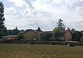
Elementary school in the town center
Day care center on Neue Meinigstrasse


Volunteer firefighter
The local fire brigade Harlingerode covers the districts of Harlingerode and Göttingerode . In the course of the Harzburg model , named after the city area, the five local fire brigades in Bad Harzburg have different focus areas, so that the Harlingeröder fire brigade, in addition to basic coverage, also maintains a respiratory protection care center, which is responsible for all districts with the exception of the city center. There is also a command vehicle for the district fire brigade. On September 27, 2017, the achievement clasp , the highest award of the youth fire brigades, the districts of Goslar and Göttingen was awarded here.
Culture and sights

The leisure center built in the 1970s has a multi-purpose room with a maximum capacity of 400 people. There are four playgrounds and a football field in the village.
A modern ceremony in Harlingerode is the lubrication of the "earth axis" on June 3rd, the day it was first mentioned. It is a piece of metal pipe that was dug in the courtyard of the former restaurant "Zur Börse". This is to jokingly take into account the Harlingerode self-image that the world revolves around the town.
religion

The St. Marien Church in the old village center, which belongs to the provost of Bad Harzburg , was rebuilt in the Baroque style after a fire in 1748. The construction of a Catholic church on Landstrasse was considered in the 1960s, but was later rejected. The next Catholic branch church of the Hildesheim diocese ( St. Gregory VII. ) Is in Bündheim , the next mosque in Oker .
On January 1, 2018, the parishes of the districts of Harlingerode, Schlewecke, Bad Harzburg-Stadt and Bündheim came together to form an association.
Sports

On Planstrasse in the north-east of the town there is a sports home, which was inaugurated in 1922 and expanded in the 1970s, with playgrounds for football, tennis, athletics and softball. The sponsor of the place is the association MTV Brunonia Harlingerode von 1883 eV. The association was founded in 1883 in the now defunct inn "Zum Kruge", the club colors blue-yellow and the choice of the goddess Brunonia as the giver of the name reflect the membership of the duchy at that time Braunschweig at that time. In the absence of a gym and money, the exercises were carried out in a barn in this early period, the sports equipment was improvised and was still made by the company. After a while a gymnastics field was built on the “In der Nachthude” area with fixed gymnastic equipment made of wood and steel.
Other associations are:
- Billard-Snooker-Club Harlingerode eV
- Harzer Roller Harlingerode
- Germania Harlingerode cycling club
- TTC Red White Harlingerode
Soccer
The Sportclub 1918 Harlingerode eV Harlingerode was founded on March 1, 1918 as the successor to FC Hohenzollern Harlingerode from 1909 in the now closed restaurant "Zum Deutschen Kaiser".
Sport shooting
The shooting society Harlingerode v. 1927 eV is based on Göttingeröder Strasse. The current club building was built in 1963, the women's team was founded three years later. The club has stands for laser, air , small bore rifles and regular sport pistols .
Personalities
Sons and daughters of the place
- Conrad Willgerodt (1841–1930), chemist and namesake of the Willgerodt-Kindler reaction
- Bodo Kroehl (1873–1961), politician ( CDU ) and mine director
- Günther Nebelung (1896–1970), lawyer
- Willi Bartels (1914–2007), "King of St. Pauli"
- Günter Riegner (1951–1995), organ builder
People connected to the place
- Wilhelm Baumgarten (1913–1996), school director, later mayor ( SPD ) of the Harlingerode community and president of the Lower Saxony state parliament from 1967 to 1974
- Heinrich Klages (1875–1969), a major local entrepreneur
- Horst Voigt (* 1933), former community director ( SPD ) of the Harlingerode community and president of the Lower Saxony Association of Cities
- Heinz Hoenig (* 1951), actor, grew up in Harlingerode

literature
- Karl Ewald Schmidt: Chronicle and local history of the parish village Harlingerode, Harzburg office, Wolfenbüttel district. Bad Harzburg 1953, OCLC 237682920 .
- Alfred Breustedt: 950 years of Harlingerode. 1053-2003. (Ortschronik) Harlingerode 2003, OCLC 249318716 .
- Bernd Stenal: The Harz story. Volume 1-7. 2015.
Web links
- Historical photos and information
- Harlingerode PUR eV, local association
- Odor nuisance in the Oker / Harlingerode area - list of presentations by the State Trade Inspectorate Braunschweig and the district of Goslar on the PRIBOH project
Individual evidence
- ↑ Value in Wikipedia Inkscape estimate. Book value of the area of the old community minus the area of Göttingerode: 12.97 km² (Alfred Breustedt: 950 years Harlingerode , 2003. p. 20.) - 1.35 km² (Horst Voigt: 40 years Göttingerode. 1936 to 1976. September 1976. p. 8.) = 11.62 km² .
- ↑ a b Source: City of Bad Harzburg, in: Goslarsche Zeitung : Immigrants save the population statistics , January 15, 2020.
- ^ LGLN : Metadata recording Lower Saxony
- ↑ Gerhard Köbler: Bode in der deutschen Ortsgeschichte, 2016-12-21 on koeblergerhard.de , written on December 21, 2016, accessed on September 13, 2017.
- ↑ Jan Habermann: The expansion of rule of the Counts of Wernigerode on the northern Harz (1249-1369) . Chemnitz University of Technology 2006, p. 33 ( qucosa.de [PDF; 1000 kB ; accessed on October 6, 2018]).
- ↑ Richard Wieries: Names of mountains, cliffs, valleys, springs, streams, ponds, villages, floor parts, forestry places and ways in District Court District Harzburg . In: Landesverein für Heimatschutz in the Duchy of Braunschweig (ed.): The field names of the Duchy of Braunschweig . tape 1 . E. Appelhans & Comp. GmbH, Braunschweig 1910, p. 28–30 ( PDF file on the TU Braunschweig publication server ).
- ↑ Hilmar von Strombeck: On the history of some devastation in the immediate vicinity of Harzburg. In: Journal of the Harz Association for History and Antiquity. Volume 6. 1873. pp. 155f.
- ^ Sabine Wilke: The Goslar Reichsgebiet and its relations to the territorial neighboring powers . Göttingen 1970, p. 59 ( limited preview in Google Book search).
- ↑ Christoph Römer, Bernd Feicke (Ed.): Harz-Zeitschrift 2002/03 . Lukas Verlag for art and intellectual history, Berlin 2004, ISBN 3-936872-16-3 , p. 271 .
- ^ Harald Meier, Kurt Neumann: Bad Harzburg. Chronicle of a city. P. 465.
- ↑ a b Operations Department | Fire Department of the City of Bad Harzburg on feuerwehr-badharzburg.de , accessed on January 14, 2018.
- ↑ Peter Schyga, Frank Jacobs, Friedhart Knolle: Give us back our dignity . War production and forced labor in Goslar 1939 - 1945. ( online publication ).
- ^ Harald Meier, Kurt Neumann: Bad Harzburg. Chronicle of a city. P. 413.
- ^ Wilhelm Baumgarten : Americans occupied the hospital town of Harzburg without a fight . 1985. Retrieved from archiv-vegelahn.de on December 9, 2017.
- ↑ Der Spiegel : “Enjoyment is no longer possible” . July 19, 1971. Retrieved March 3, 2019.
- ↑ a b Horst Voigt: 40 years Göttingerode. 1936 to 1976. Bad Harzburg, September 1976. pp. 51-54.
- ↑ Landstrasse (PDF) on stadt-bad-harzburg.de , accessed on March 3, 2018.
- ^ Line Bad Harzburg - Goslar - eisenbahn-harzvorland.de
- ^ Federal Statistical Office (ed.): Historical municipality directory for the Federal Republic of Germany. Name, border and key number changes in municipalities, counties and administrative districts from May 27, 1970 to December 31, 1982 . W. Kohlhammer GmbH, Stuttgart and Mainz 1983, ISBN 3-17-003263-1 , p. 272 .
- ↑ Wind power plants: Kaltes Feld wind farm on proplanta.de , accessed on March 4, 2018.
- ↑ Brochure of the Mansfeld-Löbbecke Foundation
- ↑ Harlingerode local fire brigade on feuerwehr-badharzburg.de , accessed on March 26, 2019.
- ^ Joachim Hellmer : Contributions to criminal geography . Duncker and Humblot, Berlin 1981, ISBN 978-3-428-04916-5 , The Influence of Tourism on Crime, pp. 65 ( limited preview in Google Book search).
- ↑ Country and ethnology . A geographic reader. tape 19 . Landes-Industrie-Comptoirs, Weimar 1818, p. 487 ( limited preview in Google Book search).
- ↑ DIVO Institute for Economic Research, Social Research and Applied Mathematics (ed.): The West German Market in Numbers . The West German market in figures, Volume 4. Volume 4 . Willi Koerbel-Habsheim , 1969, p. 461 .
- ^ Alfred Breustedt: 950 years of Harlingerode . 1053-2003. Local history. Harlingerode 2003, OCLC 249318716 ( manuscript on historisches-harlingerode.de ).
- ↑ The district of Goslar at a glance. Numbers, data, facts. District of Goslar, December 3, 2018, accessed on December 20, 2019 .
- ↑ Heinz-Georg Breuer: Heavy metal: A legacy that is forever in the ground . In: Goslarsche Zeitung . September 6, 2018.
- ^ Lower Saxony Ministry for the Environment, Energy, Building and Climate Protection : Deposition measurements in Oker-Harlingerode on Environment.niedersachsen.de
- ^ Project Immission Complaints Oker-Harlingerode , accessed on November 7, 2018.
- ↑ Protection against harmful air pollution in Oker-Harlingerode on olaf-lies.de , accessed on June 10, 2019.
- ^ Goslarsche Zeitung : The Fun Factory closes . June 7, 2018, accessed April 7, 2019.
- ↑ Map of the Bad Harzburg-Nord industrial area including expansion ( page no longer available , search in web archives ) Info: The link was automatically marked as defective. Please check the link according to the instructions and then remove this notice. , accessed on December 18, 2017 (PDF, 1.2 MB).
- ↑ Alec Pein: Kaltes Feld: Is an industrial area coming now? on regionalgoslar.de , published on August 18, 2016, accessed on December 17, 2017.
- ^ Goslarsche Zeitung : Industrial area Kaltes Feld and western bypass Harlingerode: Movement and traffic jam report, published on January 2, 2003, accessed on December 17, 2017.
- ↑ Goslarsche Zeitung : Combined bike and footpath between Oker and Bad Harzburg . October 24, 2018, accessed October 25, 2018.
- ↑ Primary schools / City of Bad Harzburg on stadt-bad-harzburg.de ( memento of the original from September 13, 2017 in the Internet Archive ) Info: The archive link has been inserted automatically and has not yet been checked. Please check the original and archive link according to the instructions and then remove this notice. , accessed June 6, 2017.
- ↑ Two first classes in Harlingerode at live.goslarsche.de , August 12, 2018, accessed on August 13, 2018
- ↑ Kita Harlingerode / City of Bad Harzburg on stadt-bad-harzburg.de ( memento of the original from September 13, 2017 in the Internet Archive ) Info: The archive link was automatically inserted and not yet checked. Please check the original and archive link according to the instructions and then remove this notice. , accessed June 6, 2017.
- ↑ Lebenshilfe Goslar - Special Education Kindergarten "Lollipop" on Lebenshilfe-goslar.de , accessed on June 6, 2017.
- ↑ 129 youth fire brigade members received the highest distinction | Goslar on regionalgoslar.de , accessed on October 4, 2017.
- ↑ Harlingerode Leisure Center at Veranstaltungenlokationen.de , accessed on March 24, 2018.
- ↑ Birthday is coming - the earth axis is lubricated on live.goslarsche.de , accessed on July 5, 2018.
- ↑ Goslarsche Zeitung : Joint worship service - church congregations form association , written and accessed on December 31, 2017.
- ↑ Chronicle of MTV Brunonia Harlingerode from 1883 eV ( Memento from December 8, 2015 in the Internet Archive )
- ↑ Schützengesellschaft Harlingerode - Club history , accessed on December 17, 2017.

Bad Harzburg (city center) (with Ottenhai ) | Bettingerode (with Altfelder Krug and Gut Radau ) | Bündheim | Eckertal | Göttingerode | Harlingerode (with Steinfeld ) | Schlewecke (with Radauanger ) | Westerode (with Mathildenhütte and spring settlement )