Fuhse Canal (Celle)
| Fuhse Canal | ||
|
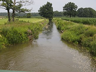
The Fuhse Canal near the confluence with the Aller |
||
| Data | ||
| location | Lower Saxony , Germany | |
| River system | Weser | |
| Drain over | Aller → Weser → North Sea | |
| Start as | Continuation of the Alte Aue from the former confluence with the Fuhse north of Nienhagen 52 ° 34 ′ 12 ″ N , 10 ° 5 ′ 47 ″ E |
|
| Source height | 38 m above sea level NHN | |
| End (mouth) | in the Aller northeast of Hambühren Coordinates: 52 ° 38 '33 " N , 9 ° 59' 31" E 52 ° 38 '33 " N , 9 ° 59' 31" E |
|
| Mouth height | 34 m above sea level NHN | |
| Height difference | 4 m | |
| Bottom slope | 0.33 ‰ | |
| length | 12.2 km | |
| Catchment area | 467 km² | |
| Discharge at the mouth of the A Eo : 467 km² |
MQ Mq |
2.35 m³ / s 5 l / (s km²) |
| Left tributaries | Alte (Burgdorfer) Aue, Neue (Burgdorfer) Aue, Adamsgraben | |
| Medium-sized cities | Celle | |
| Communities | Hambühren | |
| Lower course of the Burgdorfer Aue | ||
The Fuhse Canal (also Aller-Fuhse Canal ) is a 12.2 kilometer long canal that was built in 1766–1769 and directs high water portions of the Fuhse southwest around the town of Celle to the Aller . The Fuhse Canal is also the lower course of the Burgdorfer Aue , which flowed into the Fuhse at the current junction until the Fuhse Canal was built.
course
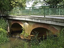
The canal begins north of Nienhagen , right where the Alte Aue , which now has little water, flowed into the Fuhse before the canal was built, but is now directed into the Fuhsekanal. After 2.5 kilometers, the canal running in a north-westerly direction between Adelheidsdorf and Celle crosses Kreisstraße 84. Shortly thereafter, east of the Lehrte – Celle railway line, it takes on the Neue Aue, the actual main line of the Burgdorfer Aue. Further to the northeast of the channel between crosses Celle-Neustadt and Celle-Wietzenbruch the airbase Celle . This is where the Adamsgraben flows from the left , which a few years after the completion of the Fuhse Canal was created by the citizens of Celle to drain the eastern Wietzenbruch. The Fuhsekanal crosses the B 214 east of Hambühren and then a municipal road over what is probably the oldest arched bridge in the district of Celle, built in 1795. About 700 meters further north, the Fuhsekanal joins the Aller.
With the construction of the Fuhse Canal, the groundwater level in the southwest of the city of Celle was lowered by a good one meter. The water of the Burgdorfer Aue and thus the canal is relatively heavily polluted with salts.
Individual evidence
- ↑ Aligse gauge value (Burgdorfer Aue), increased by the discharge of the remaining catchment area (287 km²) up to the confluence with the Aller, determined for the relevant intermediate catchment area of the Celle , Wathlingen , Aligse , Feuerschützenborstel , Wieckenberg and Marklendorf gauges (4.2 l / s km²). This value does not take into account the proportion of Fuhse floods that is cut into the Fuhse Canal.
- ↑ a b c Lower Saxony State Agency for Water Management, Coastal Protection and Nature Conservation (NLWKN): Water quality report Fuhse-Wietze 2003 (PDF; 6.6 MB) , accessed on October 29, 2013

