Burgdorfer Aue
| Burgdorfer Aue | ||
|
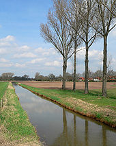
Burgdorfer Aue near Hülptingsen |
||
| Data | ||
| Water code | DE : 4854 (Fuhsekanal) ← 48544 | |
| location | Germany , Lower Saxony | |
| River system | Weser | |
| Drain over | Aller → Weser → North Sea | |
| source | west of Equord 52 ° 17 ′ 21 ″ N , 10 ° 5 ′ 39 ″ E |
|
| Source height | 73 m above sea level NHN | |
| muzzle | by means of the Fuhsekanal near Hambühren to the Aller coordinates: 52 ° 38 '33 " N , 9 ° 59' 31" E 52 ° 38 '33 " N , 9 ° 59' 31" E |
|
| Mouth height |
33 m above sea level NHN (Aue 40 m above sea level , Neue Aue 39 m above sea level )
|
|
| Height difference | 40 m | |
| Bottom slope | 0.7 ‰ | |
| length | 57.4 km (without Fuhse Canal: 48.9 km) |
|
| Catchment area | 464.1 km² (with Fuhse Canal) | |
| Discharge at the Aligse A Eo gauge : 180 km² Location: 31.7 km above the mouth |
NNQ (June 22, 2014) MNQ 1985/2014 MQ 1985/2014 Mq 1985/2014 MHQ 1985/2014 HHQ (January 3, 2003) |
106 l / s 203 l / s 1.13 m³ / s 6.3 l / (s km²) 14.6 m³ / s 26.5 m³ / s |
| Discharge at the mouth of the A Eo : 464.1 km² |
MNQ MQ Mq |
280 l / s 2.1 m³ / s 4.5 l / (s km²) |
| Left tributaries | Schanze, Billerbach, Lehrter Bach, Bruchgraben, Hainholzbach, Hechtgraben | |
| Right tributaries | Seebeck | |
| Medium-sized cities | Lehrte , Burgdorf | |
| Communities | Hohenhameln , Uetze , Nienhagen | |
| Navigable | No | |
| Was separated from the river system of the Fuhse by the construction of the Fuhse Canal | ||
The Burgdorfer Aue is a left tributary of the Aller in Lower Saxony . The name refers to the town of Burgdorf northeast of Hanover . Until the 18th century, the Burgdorfer Aue was a left tributary of the Fuhse .
course


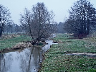
The Burgdorfer Aue is created by the confluence of several drainage ditches north of Hohenhameln . It bears its name from Equord in the district of Peine . To the north of Mehrum it is passed in a culvert under the Mittelland Canal and then runs in a north-westerly direction, between the Hämeler Wald in the east and the town of Lehrte in the west. The Lehrter Bach flows here from the left. From now on, the river Steinwedel passes northwards and crosses the town of Burgdorf in two arms. North of Obershagen , the Burgdorfer Aue branches nowadays into the Alte Aue, which flows further northeast (right, GKZ: 48542) and the north-facing Neue Aue (left, GKZ: 48544). Both flow into the Fuhse Canal (GKZ: 4854).
The Neue Aue carries the main amount of water at low to medium water levels, but the branching is designed so that its flow has an upper limit. When the tide is high, most of it flows through the Alte Aue. This takes up the Thöse after 1.8 km from the right and is only called Aue from here on . At the (earlier) confluence of the floodplain from the left into the Fuhse in the north of Nienhagen , the Fuhsekanal branches off to the left of the same today. Because of a built-in threshold (there was even a weir here for a long time ), no water from the foot itself reaches the canal at low tide. On the other hand, it normally absorbs the water of the floodplain completely. Three and a half kilometers downstream near Westercelle , the canal takes on the Neue Aue.
Environment and nature protection
The water of the Burgdorfer Aue has consistently quality class II – III: "critically polluted".
In March 2016, the Burgdorf Hunters' Association reported the return of the beaver to the Burgdorfer Aue, which is seen as an indication of good water quality.
According to an ordinance of the former municipal association Greater Hanover (today Region Hanover ) from 1969, large parts of the Burgdorfer Aue between Lehrte and Burgdorf with a size of 751.7 hectares have been declared a landscape protection area.
The Burgdorfer Aue is used as a fishing water. Occurring fish species are eel , rod , pike , catfish , perch , tench , brown trout and white fish .
Art in the course of the Burgdorfer Aue
Under the project Gartenregion 2009 the Hanover region has been the course of Burgdorfer Aue with six sculptures , known as "landmarks" provided. For this purpose, artists from the region have created works of art relating to the respective location, which are spread over a length of around forty kilometers. Two of the sculptures are in Sehnde- Dolgen , others are in Lehrte, in Burgdorf on the horse market, in Uetze-Obershagen and near Ehlershausen . Locations and names refer to the altitude of the water, with a sculpture every five meters. Their increasing distances downstream illustrate the typically decreasing gradient towards the lower reaches.
literature
- Matthias Blazek and Wolfgang Evers: "The water conditions - when the moor was still under water", in: Villages in the shadow of the Müggenburg . Adelheidsdorf 1997, p. 99ff.
- Reinhard Scheelje and Heinz Neumann: History of the city of Burgdorf and its districts from the beginning to the beginning of the 20th century . Burgdorf 1992.
Web links
Individual evidence
- ↑ Measurement in TK 25.
- ↑ Water quality report Fuhse-Wietze 2003 series of publications, Volume 9, of the former NLWK - text available as PDF .
- ^ Deutsches Gewässerkundliches Jahrbuch Weser-Ems 2014. Lower Saxony State Agency for Water Management, Coastal Protection and Nature Conservation, p. 184, accessed on October 4, 2017 (PDF, German, 8805 kB).
- ↑ Aligse gauge value , increased by the area runoff of the 221 km² remaining catchment area, approximated from the relevant intermediate catchment area of the Celle , Wathlingen , Aligse , Feuerschützenborstel , Wieckenberg and Marklendorf gauges (4.2 l / s km²).
- ↑ Aue estuary water quality map .
- ↑ Burgdorfer Aue water quality map .
- ↑ Burgdorf Hunters' Association
- ↑ The ordinance stipulates the following: "In the protected area, actions are prohibited that are likely to deface the landscape, damage nature or impair the enjoyment of nature."
- ^ Sport fishing association Burgdorf e. V. Aue ( Memento of the original from November 14, 2016 in the Internet Archive ) Info: The archive link was inserted automatically and has not yet been checked. Please check the original and archive link according to the instructions and then remove this notice.
- ↑ Hannover.de: Six “Landmarks” will be available from August 15th in Burgdorfer Aue, PDF file (1200 kB).
- ↑ Marktspiegel / Lehrter Nachrichten of August 22, 2009, p. 1f .: The garden region has now also arrived in nature .
- ↑ Hannover.de: Map of Radtour Landmarks Burgdorfer Aue , PDF file ( Memento of the original from October 2, 2013 in the Internet Archive ) Info: The archive link was inserted automatically and has not yet been checked. Please check the original and archive link according to the instructions and then remove this notice. (1318 kB).


