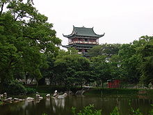
Ganzhou
Ganzhou ( Chinese 赣 州市 , Pinyin Gànzhōu Shì ) is a district-free city in the Jiangxi Province of the People's Republic of China and has an area of 39,379.64 km² with around 8,595,000 inhabitants (end of 2016). 1,035,911 people live in the actual urban settlement area of Ganzhou (2010 census).
Administrative structure
At the county level, Ganzhou consists of three urban districts , 14 districts and one urban district. These are:
- Zhanggong District (章贡区), 479 km², approx. 500,000 inhabitants;
- Nankang district (南康 区), 1,845 km², approx. 780,000 inhabitants;
- Ganxian district (赣 县区), 2,993 km², approx. 550,000 inhabitants;
- Xinfeng County (信丰县), 2,878 km², approx. 660,000 inhabitants;
- Dayu County (大 余 县), 1,368 km², approx. 280,000 inhabitants;
- Shangyou district (上犹县), 1,544 km², approx. 280,000 inhabitants;
- Chongyi County (崇义 县), 2,197 km², approx. 200,000 inhabitants;
- Anyuan County (安 远 县), 2,375 km², approx. 340,000 inhabitants;
- Longnan District (龙 南县), 1,641 km², approx. 300,000 inhabitants;
- Dingnan district (定 南县), 1,316 km², approx. 200,000 inhabitants;
- Quannan district (全 南县), 1,521 km², approx. 180,000 inhabitants;
- Circle Ningdu (宁都县), km² 4053, about 710,000 inhabitants;
- Yudu County (于都县), 2,893 km², approx. 880,000 inhabitants;
- Xingguo County (兴国 县), 3,214 km², approx. 710,000 inhabitants;
- Circle Huichang (会昌县), 2,722 km², about 430,000 inhabitants;
- Circle Xunwu (寻乌县), 2,311 km², about 290,000 inhabitants;
- Shicheng County (石城县), 1,582 km², approx. 300,000 inhabitants;
- City of Ruijin (瑞金 市), 2,448 km², approx. 590,000 inhabitants.
Between 1929 and 1934, Ganzhou was part of the Jiangxi Soviet, one of the bases of the Chinese Communist Party. Because of the proximity of the center of Ganzhou to the red capital Ruijin, the city was the victim of a series of encirclement attempts by the Kuomintang .
Climate table
| Ganzhou | ||||||||||||||||||||||||||||||||||||||||||||||||
|---|---|---|---|---|---|---|---|---|---|---|---|---|---|---|---|---|---|---|---|---|---|---|---|---|---|---|---|---|---|---|---|---|---|---|---|---|---|---|---|---|---|---|---|---|---|---|---|---|
| Climate diagram | ||||||||||||||||||||||||||||||||||||||||||||||||
| ||||||||||||||||||||||||||||||||||||||||||||||||
|
Average monthly temperatures and rainfall for Ganzhou
Source: wetterkontor.de
|
|||||||||||||||||||||||||||||||||||||||||||||||||||||||||||||||||||||||||||||||||||||||||||||||||||||||||||||||||||||||||||||||||||||||||||||||||||||||||||||||||||||
Town twinning
-
 Freetown , since 2008
Web links
Commons : Ganzhou - collection of pictures, videos and audio files
Individual evidence
- ↑ News. Freetown City Council, March 21, 2009. ( December 17, 2009 memento in the Internet Archive )
Coordinates: 25 ° 50 ' N , 114 ° 56' E


