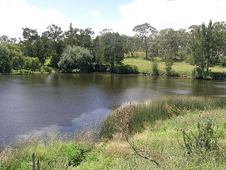
Gara River (Macleay River)
|
Gara River, Guyra River |
||
|
Blue Hole on the Gara River near Armidale |
||
| Data | ||
| location | New South Wales , Australia | |
| River system | Macleay River | |
| Drain over | Macleay River → Tasman Sea | |
| source | at Llangothlin in the Great Dividing Range 30 ° 8 ′ 43 ″ S , 151 ° 42 ′ 13 ″ E |
|
| Source height | 1280 m | |
| muzzle |
Macleay River in Oxley Wild Rivers National Park Coordinates: 30 ° 40 ′ 13 ″ S , 151 ° 50 ′ 59 ″ E 30 ° 40 ′ 13 ″ S , 151 ° 50 ′ 59 ″ E |
|
| Mouth height | 388 m | |
| Height difference | 892 m | |
| Bottom slope | 9.8 ‰ | |
| length | 90.6 km | |
| Left tributaries | Cooney Creek | |
| Right tributaries | Ryanda Creek, Commissioners Waters, Powers Creek | |
| Reservoirs flowed through | Lake Guyra , Malpas Reservoir | |
The Gara River (also Guyra River ) is a perennial river in the northeast of the Australian state of New South Wales . It is one of the headwaters of the Macleay River .
geography
The river rises below the small town of Llangothlin , around 15 kilometers north of Guyra and around 40 kilometers north of Armidale on the eastern slopes of the Great Dividing Range . From its source, the river flows south through unpopulated land east of the cities of Guyra and Armidale. To the southeast of Armidale, the river enters the Oxley Wild Rivers National Park and, together with Salisbury Water, forms the Macleay River.
Reservoirs
On its way, the Gara River flows through two reservoirs, Lake Guyra at an altitude of 1273 m and the Malpas Reservoir at 1174 m.
Tributaries with mouth heights
- Ryanda Creek - 1273 m
- Commissioners Waters - 915 m
- Powers Creek - 889 m
- Cooney Creek - 434 m
See also
Individual evidence
- ↑ a b c d e Map of Gara River, NSW . Bonzle.com
- ^ Steve Parish: Australian Touring Atlas . Steve Parish Publishing Pty. Ltd. Archerfield QLD (2007). ISBN 978174193232-4
