Garango
| Garango | ||
|---|---|---|
| Status: | commune urbaine | |
| Region: | Center-Est | |
| Province: | Boulgou | |
| Surface: | ||
| Residents: | 71,408 | |
| Population density: | ||
| Structure: | 7 sectors / 14 villages | |
| Mayor: | André Marie Zouré | |
| Prefect: | Ibrahim Soré | |
| location | ||
|
|
||
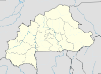
Garango is a city (commune urbaine) and a department in the West African state of Burkina Faso , in the Center-Est region and the Boulgou province . The city is located north of Mount Boulgou and has 71,408 inhabitants.
geography
Garango covers an area of about 79 km². The city is divided into 7 sectors and unites 14 villages (quartiers traditionnels). The unification took place on the instructions of the military authorities in 1958. In 1960 Garango became the seat of a sub-prefecture. A law from 1982 made Garango a city, this law was implemented in early 1983 with the appointment of a Préfet Maire . On October 8, 1999, the city limits were redefined. Garango has been reduced in size compared to 1983.
Garango is the seat of the Naaba ("Elector", currently governs Naaba Koom) and the capital of the Bissa , who immigrated at the beginning of the 19th century.
economy
Garango is the local "regional center" in the province of Boulgou with prefecture, hospital with doctor, school inspection, lycée, colleges, post office, agricultural cooperative , Poste des Eaux et des Forets, Mission Catholique (since 1933), mosque, Center Feminin, Center des Handicapes , Center des Orphelins, center for the blind, craft school, craftsmen (locksmiths, carpenters, bricklayers, painters, tailors, leather makers), cattle market, slaughterhouse and veterinary station.
The economy is characterized by agriculture with the cultivation of the millet types sorghum (13%) and pearl millet (68%), rice, corn, onions, peanuts, vegetables and some cotton, as well as the keeping of pigs, sheep, goats and guinea fowl (small cattle: around 10,000 free roaming in the urban area, the animals fertilize the many “house fields” in the city). Only a small number of onions are exported. The land is worked with the hoe ( dhaba ) (0.6 ha / worker), occasionally with light plows. The workhorse is the donkey. Large cattle (zebu cattle and cattle) are driven through the country on behalf of the nomadic Peulh . Dairy farming is unknown. Every three days there is a market where mainly agricultural products are sold.
climate
The climate is characterized by the change between dry and rainy seasons (end of May to end of September). The productivity of the rains varies greatly, with an average of around 700 mm. The temperatures are between 20 ° C (December) and over 40 ° C (April, May).
Twin cities
See also
Web links
Individual evidence
- ↑ Preliminary results of the 2006 census ( Memento of the original from July 21, 2015 in the Internet Archive ) Info: The archive link was inserted automatically and has not yet been checked. Please check the original and archive link according to the instructions and then remove this notice. (PDF; 3.16 MB)
- ↑ Council of Ministers, July 26, 2006 ( Memento of the original from October 6, 2007 in the Internet Archive ) Info: The archive link was automatically inserted and not yet checked. Please check the original and archive link according to the instructions and then remove this notice.
Coordinates: 11 ° 48 ′ N , 0 ° 33 ′ W
