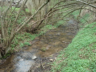
Geißbach (Kleinaschaff)
| Geissbach | ||
|
The Geißbach in front of its mouth |
||
| Data | ||
| location |
Spessart
|
|
| River system | Rhine | |
| Drain over | Kleinaschaff → Aschaff → Main → Rhine → North Sea | |
| source | on the Heidberg south of Waldaschaff 49 ° 57 '14 " N , 9 ° 18' 27" E |
|
| Source height | 279 m above sea level NHN | |
| muzzle | under the Kauppenbrücke to Kleinaschaff Coordinates: 49 ° 57 ′ 45 " N , 9 ° 18 ′ 20" E 49 ° 57 ′ 45 " N , 9 ° 18 ′ 20" E |
|
| Mouth height | 213 m above sea level NHN | |
| Height difference | 66 m | |
| Bottom slope | 60 ‰ | |
| length | 1.1 km | |
| Catchment area | 1.8 km² | |
The Geißbach is a left tributary of the Kleinaschaff in the district of Aschaffenburg in the Bavarian Spessart .
geography
course
The Geißbach rises on Heidberg ( 390 m above sea level ), south of Waldaschaff in the Waldaschaff forest . It flows in a northerly direction and flows into the Kleinaschaff under the newly built Kauppenbrücke .
Aschaff river system
See also
Web links
Commons : Geißbach - Collection of images, videos and audio files
Individual evidence
- ↑ a b c d BayernAtlas of the Bavarian State Government ( notes )
- ↑ Topographical Atlas of the Kingdom of Bavaria on this side of the Rhine from 1860

The Geißbach (right pipe) flows into the Kleinaschaff (left pipe)
