State geognostic survey of Saxony
The geognostic state survey of Saxony was the first comprehensive geological survey of the entire Electorate of Saxony and was started at the end of the 18th century.
occasion
Although the "Petrographic Chart of the Electorate of Saxony" by Johann Friedrich Wilhelm von Charpentier (1738–1805) was the first geological map available as a rough overview of the geology of Saxony since 1778 , just a few years later the map no longer met the requirements of resource exploration . The research that was started by Nathanael Gottfried Leske (1751–1786), a close friend of Abraham Gottlob Werner (1749–1817), produced new insights. Leske was torn from his investigations planned for the entire territory of Saxony due to his untimely death, so that his research results only related to Upper Lusatia .
Above all, the increasing shortage of fuels prompted the Saxon government to order the search for hard coal in 1788 . After Abraham Gottlob Werner had already requested a detailed investigation of the Erzgebirge ore deposits in 1786 , the Oberbergamt in Freiberg expanded the order to include mineral raw materials and organized a geognostic state survey.
The country mapping under Abraham Gottlob Werner
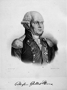
Werner received the official assignment for this task in 1791. He divided Saxony into 92, later into 111 districts and used distinctive landforms as borders, including the neighboring countries. Each mapping unit (district) had to be worked on by an “educated and experienced academic” together with a “younger student”. A mapping guide described that a relation had to consist of a "chronological examination protocol" and a "systematic description of the results". Furthermore, an “illuminated petrographic chart” was required. Werner did not leave the mappers to design this map. He developed a color and symbol table and assigned colors to the rocks. Additional signs emphasized special geological features. In principle, this system of double signing for geological units still applies today.
Equipped and informed in this way, researched field geologists such as Sigismund August Wolfgang von Herder , Johann Carl Freiesleben , Wilhelm Gottlob Ernst Becker , Johann Wilhelm Otto Freiesleben , Friedrich Constantin Freiherr von Beust , Richard Freiherr von Friesen , Friedrich Freiherr von Hardenberg , Carl Christian Martini , Friedrich Gotthold Oehlschlägel , Karl Gustav Adalbert von Weissenbach , Gottlob Friedrich Blöde , Johann Friedrich August Breithaupt and Carl Amandus Kühn the country. Twenty years after the work began, the main report drawn up by Werner and Carl Amandus Kühn was presented in September 1811. Up to this point in time, 35 left Elvish and one right Elvish district had been mapped according to Werner's specifications. Numerous lignite deposits and other mineral resources were discovered that have already been mined. The report also contained the plan for further work, which was to be completed at the end of 1817 with the publication of a mineralogical - geographical description of Saxony.
Due to the unpredictable political events in the turmoil of the Napoleonic Wars , the investigations could only be continued to a very limited extent, and Werner was seriously ill.
The special geognostic map for Saxony
After Werner's death in 1817, Bergkommissionsrat Kühn became director of the state investigation and conducted the geological research until 1835. At this time, the maps were revised by Carl Friedrich Naumann (1797–1873) and Bernhard Cotta . After Naumann left for Leipzig in 1842, Cotta became his successor as Professor of Geognosy at the Freiberg Mining Academy . In the years 1835–1845 the Bergakademie was able to publish the special geognostic map for Saxony and the neighboring countries as a summary .
The topographical basis of this special map was the lithographed so-called " Schliebensche " map of Saxony and the neighboring countries, which had been compiled in 24 sections , but only 11 sections were used after the Vienna Congress of 1815 due to the loss of territory of two thirds of the country .
The Saxon Geological State Survey
After a thorough and large-scale re-mapping (1:25 000) of Saxony became necessary in the middle of the 19th century due to new economic and political situations, the Saxon Geological State Survey was founded in Leipzig in 1872 , under the direction of Prof. Hermann Credner on a new basis the systematic exploration and description of the geological conditions in Saxony started by Werner and was subordinate to the Ministry of Finance. Today's Saxon State Office for Environment and Geology emerged from it.
Already before that, in 1846, at the instigation of the chief miner Friedrich Constantin Freiherr von Beust , the gait investigation commission had been formed, which was attached to the Freiberg Higher Mining Authority and from 1869 to the Freiberg Mining Authority, and which was dedicated to the exploration of ore deposits. Its effectiveness can be traced back to 1890. With the decline of the Saxon silver mining , the closure of numerous mines and the consolidation of the remaining fiscal mines, it ceased its activities. The works of Carl Hermann Müller (known as the "Gangmüller"), Franz Robert Heucke and Wolfgang Vogelgesang should be mentioned in particular .
Today's meaning
Even from today's perspective, the work of the initial mappers is still important, and their maps are still used for comparison purposes, which speaks for the high quality of the mapping. Comparisons with the maps of the geognostic state survey of Saxony are still of great value today, especially due to the changed geological exposure situation.
Web links
- Inventory 40003 Oberbergamt Freiberg - Geognostic gait and national commission of inquiry in Mining Archives
- Special geological map of the Kingdom of Saxony, 1:25 000, lithograph, 1886-1914 . Deutsche Fotothek, SLUB Dresden

