
Gibb River Road
| Gibb River Road | |||||||||||||||||||||||||||||||||||||||||||||||||||||||||||||||||||||||||||||||||||||||||||
|---|---|---|---|---|---|---|---|---|---|---|---|---|---|---|---|---|---|---|---|---|---|---|---|---|---|---|---|---|---|---|---|---|---|---|---|---|---|---|---|---|---|---|---|---|---|---|---|---|---|---|---|---|---|---|---|---|---|---|---|---|---|---|---|---|---|---|---|---|---|---|---|---|---|---|---|---|---|---|---|---|---|---|---|---|---|---|---|---|---|---|---|
| map | |||||||||||||||||||||||||||||||||||||||||||||||||||||||||||||||||||||||||||||||||||||||||||
 |
|||||||||||||||||||||||||||||||||||||||||||||||||||||||||||||||||||||||||||||||||||||||||||
| Basic data | |||||||||||||||||||||||||||||||||||||||||||||||||||||||||||||||||||||||||||||||||||||||||||
| Operator: | Main Roads | ||||||||||||||||||||||||||||||||||||||||||||||||||||||||||||||||||||||||||||||||||||||||||
| Start of the street: |
South of Wyndham ( WA ) ( 15 ° 50 ' S , 128 ° 19' O ) |
||||||||||||||||||||||||||||||||||||||||||||||||||||||||||||||||||||||||||||||||||||||||||
| End of street: |
Derby Highway Derby ( WA ) ( 17 ° 21 ′ S , 123 ° 40 ′ E ) |
||||||||||||||||||||||||||||||||||||||||||||||||||||||||||||||||||||||||||||||||||||||||||
| Overall length: | 660 km | ||||||||||||||||||||||||||||||||||||||||||||||||||||||||||||||||||||||||||||||||||||||||||
|
States : |
|||||||||||||||||||||||||||||||||||||||||||||||||||||||||||||||||||||||||||||||||||||||||||
 |
|||||||||||||||||||||||||||||||||||||||||||||||||||||||||||||||||||||||||||||||||||||||||||
|
Course of the road
|
|||||||||||||||||||||||||||||||||||||||||||||||||||||||||||||||||||||||||||||||||||||||||||
The Gibb River Road is a trunk road in the north of the Australian state of Western Australia . It connects the Great Northern Highway south of Wyndham with the Derby Highway at Derby . It leads through the middle of the Kimberley region and, in contrast to the Great Northern Highway, which runs further south, represents the direct connection between the two cities.
history
The history of Gibb River Road begins in 1960 as a beef road . So it was created to transport slaughter cattle from the remote farms of the Kimberley region to Derby. At first only the southern section from Gibb River Station , from which the street owes its name, existed to Derby. In 1962, the Gibb River Road finally got its current route when the northern section was added. This northern part of the road was administered by the local authorities in Wyndham until 1996, whose limited financial means made the road in poor condition compared to the southern part. In 1996 Main Roads Western Australia took over the maintenance work on the entire route, which meant an improvement in the road condition on the northern part of the Gibb River Road.
course
The Gibb River Road branches off 48 km south of Wyndham from the Great Northern Highway (N1) to the west-southwest. Passing Emma Gorge , it curves to the northwest and reaches its northernmost point at Home Valley (south of the west arm of the Cambridge Gulf ). Initially on the Durack River upstream it leads in a south-westerly direction until it reaches the Gibb River sheep breeding station in the center of the Kimberleys. This is where the younger, northern part of the route ends.
The southern part continues to the southwest, past the Barnett River Gorge and Manning Gorge , to Kupungarri , where there is a first refueling point . Past Galvans Gorge and Adcock Gorge, the road continues southwest to Imintji Wilderness Camp at the foot of the King Leopold Ranges , where there is also a gas station. The Leopold Ranges Conservation Park , a state reserve, runs through the Gibb River Road to the west at a distance of a few kilometers from the Leonard River Gorge .
After exiting the park, the road turns southwest again until it joins Fairfield Leopold Downs Road coming from the southeast , which leads to Windjana Gorge National Park and Tunnel Creek National Park . Then the Gibb River Road moves west to reach the city of Derby after 124 km. The last 74 km of the road are paved.
Road conditions


The condition of the Gibb River Road depends heavily on the weather conditions. While it is possible to cover the route with a car in the dry season (May – October) , the road, or at least individual sections, is sometimes closed to all traffic in the rainy season (November – April). The road surface itself changes again and again from stony to sandy-earthy passages, short sections of the route are also paved. A washboard runway is typical of the Gibb River Road as an unpaved road .
tourism
The main tourist attractions along Gibb River Road are seven gorges (from east to west):
- Emma Gorge
- Barnett River Gorge
- Manning River Gorge
- Galvans Gorge
- Bell Creek Gorge
- Lennard River Gorge
- Windjana Gorge
Other attractions along the route include Tunnel Creek National Park (34 miles south on Fairfield Leopold Downs Road ) and El Questro Wilderness Park .
Tourists should note that the majority of car rental companies only allow four-wheel drive vehicles to drive on Gibb River Road because long stretches of the road are unsurfaced.
photos

Gibb River Road near Derby
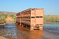
Road train on the Gibb River Road

Overview of the facilities along the Gibb River Road


literature
- Steve Parish: Australian Touring Atlas . Steve Parish Publishing. Archerfield QLD 2007. ISBN 978-1-74193-232-4 . Pp. 88 + 89
Web links
- Gibb River Road as a route (German and English)
- Gibb River Road ( Memento of January 17, 2007 in the Internet Archive ) (English)
- Road conditions
- Road trip on the Gibb River Road (English)
Individual evidence
- ↑ Gibb River Road on www.ExplorerOz.com ( s ) Archived from the original on January 17, 2007. Accessed April 13 of 2009.
- ↑ Gibb River Road - Road Conditions ( English ) Retrieved on 18 May, 2009.