Gilgit (river)
|
Gilgit Ghizer |
||
|
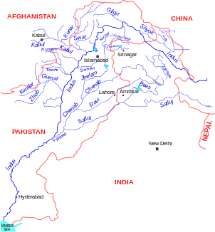
Location of the Gilgit in the river system of the Indus |
||
| Data | ||
| location | Gilgit-Baltistan ( Pakistan ) | |
| River system | Indus | |
| Drain over | Indus → Arabian Sea | |
| Source lake |
Shandur Lake 36 ° 4 ′ 44 ″ N , 72 ° 32 ′ 7 ″ E |
|
| Source height | 3728 m | |
| muzzle | at Shimrot in the Indus coordinates: 35 ° 44 ′ 27 " N , 74 ° 37 ′ 26" E 35 ° 44 ′ 27 " N , 74 ° 37 ′ 26" E
|
|
| length | 240 km | |
| Catchment area | 26,000 km² | |
| Left tributaries | Yasin , Karambar , Hunza | |
| Small towns | Gahkuch | |
|
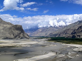
Gilgit River near Gilgit |
||
The 240-kilometer Gilgit River ( Urdu دریائے گلگت daryā-e Gilgit ; above Gahkuch the river is called Ghizer ) rises on Shandur Lake on a mountain plateau.
The Shandur Plateau with the lake is 3728 m above sea level on the Shandur Pass in Pakistan . The lake in the Hindu Kush is located on the pass path that connects the cities of Chitral and Gilgit .
The Gilgit River flows east from Lake Shandur to the city of the same name, which is located in Gilgit-Baltistan , the former Pakistani northern regions, in the Kashmir region . The river then flows into the Indus . Rafting tours are carried out on the river .
On the Shandur Plateau, on which Lake Shandur is located, a polo tournament has been held every year since 1936 according to historical rules, which has been expanded to include an open-air festival for several years.
Web links
- Illustration of the river on travelblog.org
- Illustration of the Gilgit Valley
- Crossing the Gilgit River on a seat lift
Individual evidence
- ↑ Article Gilgit in the Great Soviet Encyclopedia (BSE) , 3rd edition 1969–1978 (Russian)
- ^ Gilgit River. In: britannica.com. Retrieved December 13, 2009 .


