Chitral
|
Chitral چترال |
||
| State : |
|
|
| Province : | Khyber Pakhtunkhwa | |
| Coordinates : |
35 ° 53 ' N , 71 ° 48' E
|
|
| Height : |
1500 m
|
|
| Residents : | 20,000 (2009) | |
| Time zone : |
PST ( UTC + 5 )
|
|
|
|
||
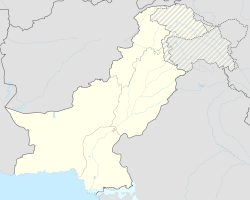
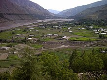
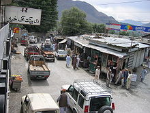
Chitral ( Urdu چترال Chatrāl ) means "field" in the Khowar language . The city lies directly on the border with Afghanistan and is the capital of the Chitral district . The village is located on the western bank of the so-called Kunar in Afghanistan , which is also known as Chitral in Pakistan . The valley of Chitral is at 1500 m above sea level.
The city is located near the 7708 m high Tirich Mir , the highest mountain in the Hindu Kush . About 20,000 people live in the village. The district of Chitral has an area of 14,833 km² and is no longer inhabited by 320,000 people.
geography
The picturesque valley of Chitral is dominated by the three peaks of Tirich Mir, which according to local beliefs are the seat of the gods. Chitral is easiest to reach from Afghanistan from the southwest along the Chitral / Kunar valley from Jalalabad . This path can be used all year round on the direct route from the Afghan capital Kabul . An international route to Peshawar leads across the border from Pakistan to Afghanistan, via the Durand Line , which is also used for the route to the south. All other paths from Chitral lead over passes, in the south over the Lowari pass , with a peak height of 3200 m to Peschawar. In the north there is an easy-to-drive route in summer over the Broghol Pass at an altitude of 3798 m from the Afghan Wakhan Corridor . This route is closed for months in winter. In the east, a path of 405 km leads to Gilgit over the 3738 m high Shandur Pass . In the west, the Dorah pass to Afghanistan cannot be used for six months in winter. Rare falcons and snow leopards can be found in this area . The road and transport problem will be solved as soon as the Lowari tunnel is completed in spring 2010, which normalizes the transport time to Chitral as well as to the other regions of Pakistan and this also during the winter.
language
Chitral takes on a special role linguistically, because it is connected to the east-west axis and north-south axis of the Silk Road at a crossroads of history. For this reason there were many influences in Chitral over the years, ranging from distant Kazakhstan and Turkmenistan to Sogdia and Bactria to Tibet and Mongolia. Likewise, Greeks, especially through Alexander the Great, as well as Persians, Huns and other peoples, had control over this valley for a time.
Chitral is therefore considered to be one of the places where most of the local languages were and are spoken in such a narrow space. The language most widely spoken in this Pakistani area is Khowar (also called Chitrali), along with 13 other dialects.
The Kalasha people speak their own language. Urdu is widely spoken and understood in most cities; The Pashtun language is also used for communication. The Khowar speak one of the Dardian languages , which are also spoken in parts of the Yasin Valley as well as in the Gilgit, Ghizer and Swat districts .
population
The largest tribe are the Khowar . Chitral is also known for the famous Kalash, the indigenous people who ruled this region for centuries and were later defeated. Today the Kalash people live in an enclave in three valleys in the west of Birir, Rumbur and Bamboret near Ayun , 16 km from Chitral.
The culture of Chitral is strictly Islamic and stands in contrast to the cities of Pakistan as well as the Gilgit district. Women are almost invisible even though they walk the streets. They wear burqas . There are also Nuristanis , Tajiks and Uzbeks in Chitral. The place has an airport ( IATA code : CJL, ICAO code : OPCH).
Sports
Next to soccer ( soccer ), polo is the most popular sport. Numerous sports festivals are held in town throughout the year. The famous polo tournament on the highest polo field in the world at 3728 m above sea level on the Shandur Pass attracts particular attention . Football players like Muhammad Rasool , who plays in the national team of Pakistan, come from Chitral . In Chitral there are football clubs and sports clubs such as the Star football club goldoor , Mogholandeh .
history
The oldest evidence is the Vedas . The story stood in the area of tension between Buddhism , Hinduism and Islam . The temples at Chaghan Saray in the Kunar Valley in the far east of Afghanistan are evidence of Hinduism.
The empire of the Mehtar , the kings of Chitral, is divided into six periods, the Persian period from 400 BC. In which Persian was spoken in Chitral, it follows 200 BC. The Kushan period , which was replaced by the Chinese period in the 4th century. The Kalash , who came from Afghanistan , were defeated by Shah Nadir Rais in the 11th century . The Katur from Chitral ended the Rais dynasty in 1595 by Muhtaram Shah I.
In the northwestern part of the Durand Line of Chitral were the historical empires of India, China and the Russian Empire, which pursued expansionist efforts. There were only a few Muslims on the Afghan side of the border . This changed at the beginning of the 19th century when they were forcibly Islamized by Abd al-Rahman and the area was named Nuristan .
In 1895 King Mehtar was murdered by his half-brother while hunting for a falcon, and a power vacuum developed. The British sent troops to Chitral, encountered heavy resistance and fled to the castle of Chitral. They were only released after a six-week siege. In 1947, the state of Chitral Pakistan joined and was finally integrated in 1969.
literature
- Kendall D. Decker: Languages of Chitral. 1992.
- Col. A. Durand: The Making of a Frontier. 1899.
- GW Leitner: Dardistan in 1866, 1886 and 1893: Being An Account of the History, Religions, Customs, Legends, Fables and Songs of Gilgit, Chilas, Kandia (Gabrial) Yasin, Chitral, Hunza, Nagyr and other parts of the Hindukush, as also a supplement to the second edition of The Hunza and Nagyr Handbook. And An Epitome of Part III of the author's "The Languages and Races of Dardistan." First Reprint 1978. Manjusri Publishing House, New Delhi 1893.
Web links
- Oliver Beckmann: Hindu Kush II: Welcome to Chitral. ( Memento from August 16, 2007 in the Internet Archive ) Scouts on Welt Online (German)
- Chitral Today
- Chitral News
- Government of Pakistan
- Map illustration of the languages in the north of Pakistan
Individual evidence
- ↑ Anna Cara: Crossing the Great Divide What could an American teaching and living in a remote Pakistani village learn from her students and neighbors? Plenty. Special to The Plain Dealer. Cleveland, Ohio, Jan 23, 2005, p. 11.
- ↑ M. Th. Houtsma, TW Arnold, AJ Wensinck: EJ Brill's First Encyclopaedia of Islam, 1913-1936. Brill, Leiden 1993, ISBN 90-04-09796-1 , p. 863.
- ^ Willem Vogelsang: The Afghans. Wiley-Blackwell, 2002, ISBN 0-631-19841-5 , p. 184.
- ^ Short History of Chitral . ( Memento of the original from January 4, 2010 in the Internet Archive ) Info: The archive link was inserted automatically and has not yet been checked. Please check the original and archive link according to the instructions and then remove this notice. (English) accessed on December 12, 2009
- ^ Rizwan Hussain: Pakistan and the emergence of Islamic militancy in Afghanistan. 2005, ISBN 0-7546-4434-0 , p. 51.


