Glösinghauser Berg
| Glösinghauser Berg | ||
|---|---|---|
|
Maschberg on the right before Börninghausen -Mesch, on the left the breakthrough valley of the Great Aue , on the left Glösinghauser Berg before Glösinghausen , on the far left Altes Verbrenn |
||
| height | 289 m above sea level NN | |
| location | Preussisch Oldendorf , North Rhine-Westphalia , Germany | |
| Mountains | Wiehengebirge | |
| Coordinates | 52 ° 15 '44 " N , 8 ° 33' 31" E | |
|
|
||
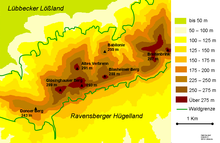
The Glösinghauser Berg is a 289 meter high mountain in the Wiehengebirge in the Minden-Lübbecke district .
The summit is in the area of the city of Preußisch Oldendorf , the second highest point of which it is. The mountain takes its name from the town of Glösinghausen , which also belongs to Preußisch Oldendorf and is located around 1.7 kilometers to the north-west. This village is not the closest to the mountain, because the village of Alingdorf , which is part of the upper farming community , is just 1 kilometer to the southeast . The Glösinghauser Berg is one of the highest mountains in the Wiehengebirge and to the west of its summit there is no higher elevation in the Wiehengebirge. 700 meters to the north-east is the Alte Verbrenn, which is 291 meters higher .
The weather shelter Glösinghauser Hütte is located 600 meters southwest of the Glösinghauser Berg, directly at the three-community corner Rödinghausen-Hüllhorst-Preußisch Oldendorf , (but just in the Preußisch Oldendorfer area) on the Wittekindsweg . The hut is located directly at the trigonometric point 239.2.


