Glinze
| Glinze | ||
|
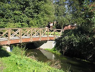
Glinze in Friedrich-Ebert-Park |
||
| Data | ||
| Water code | DE : 58922 | |
| location | Ostprignitz , Brandenburg , Germany | |
| River system | Elbe | |
| Drain over | Dosse → Havel → Elbe → North Sea | |
| source | northeast of Blesendorf (municipality of Heiligengrabe ) 53 ° 13 ′ 43 ″ N , 12 ° 21 ′ 43 ″ E |
|
| Source height | 86 m above sea level NHN | |
| muzzle | in Wittstock / Dosse in the Dosse coordinates: 53 ° 9 ′ 27 " N , 12 ° 29 ′ 14" E 53 ° 9 ′ 27 " N , 12 ° 29 ′ 14" E |
|
| Mouth height | 61 m above sea level NHN | |
| Height difference | 25 m | |
| Bottom slope | 1.6 ‰ | |
| length | 15.3 km | |
| Catchment area | 75 km² | |
| Discharge at the Wittstock A Eo gauge : 75.1 km² Location: 700 m above the mouth |
NNQ (06/24/1989) MNQ 1982–1999 MQ 1982–1999 Mq 1982–1999 MHQ 1982–1999 HHQ (01/30/1982) |
169 l / s 236 l / s 522 l / s 7 l / (s km²) 2 m³ / s 4.96 m³ / s |
|
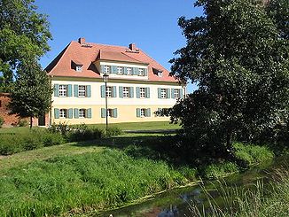
Glinze in front of the mayor's house of the old bishop's castle |
||
The Glinze is a right tributary of the Dosse in Brandenburg countryside Ostprignitz . The length of the near-natural stream is around 15.3 kilometers, the catchment area is a good 75 km².
course
The Glinze rises northeast of Blesendorf, a district of the municipality of Heiligengrabe in the district of Ostprignitz-Ruppin . In the same area is the source of the Dömnitz , which turns to the southwest and flows into the Stepenitz . The Glinze runs in the opposite direction to the southeast, reaches the village of Zaatzke and then leaves the towns of Glienicke and Jabel to the south. These three villages now also belong to Heiligengrabe as districts. After crossing under the autobahn 19 , the Glinze reaches the town of Wittstock / Dosse and flows into the Dosse south of the old town of Wittstock near the Old Bishop's Castle and the Schwedenstein .
Glinz wall in Wittstock
The last part leads the Glinze through the listed Friedrich-Ebert-Park , whose network of paths is laid out around the stream. The paths and a large part of the tree population date from around 1925. The Glinze flows parallel to the southeastern part of the preserved and restored city wall , which partly dates back to the 14th century and surrounds the city center over a length of 2.5 kilometers . In the southeastern part of the fortification ring or the inner lane is named Glinzmauer after the name of the stream .
Web links
Individual evidence
- ↑ River directory gewnet25 (Version 4.0, April 24, 2014) from the Ministry for Rural Development, Environment and Agriculture of the State of Brandenburg, accessed on May 4, 2015.
- ^ German Hydrological Yearbook Elbe Region, Part II 1999 Brandenburg State Environment Agency, p. 157, accessed on November 3, 2018, at: lugv.brandenburg.de (PDF, German).

