Grafenberg (landscape protection area)
|
Landscape protection area "Grafenberg"
|
||
|
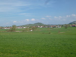
View from the west of the Grafenberg |
||
| location | Grafenberg municipality in the Reutlingen district in Baden-Wuerttemberg , Germany | |
| surface | 2.7 ha | |
| Identifier | 4.15.129 | |
| WDPA ID | 321141 | |
| Geographical location | 48 ° 34 ' N , 9 ° 18' E | |
|
|
||
| Setup date | October 28, 1965 | |
| administration | District of Reutlingen | |
Grafenberg is a protected landscape area (protected area number 4.15.129) in the Esslingen district .
Location and description
The protected area was created by ordinance of the then responsible District Office Nürtingen of October 28, 1965. It is a volcanic vent of the Swabian volcano in the Urach-Kirchheim volcanic area that went out 11 million years ago in the Miocene . The Grafenberg belongs to the natural area 101 - foreland of the middle Swabian Alb within the natural spatial main unit 10 - Swabian Keuper-Lias-Land .
Protection purpose
The main protection purpose is the preservation of the summit area of the mountain, which is characterized by orchards . Another protective purpose is the preservation of recreational space for the general public and the protection against further impairment by buildings, small buildings and enclosures.
See also
- List of landscape protection areas in the Reutlingen district
- List of landscape protection areas in Baden-Württemberg
Web links
- Characteristics of the nature reserve Grafenberg in the reserve list of LUBW


