County of Ruchesloh
Coordinates: 50 ° 45 ' N , 8 ° 42' E
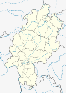
The county Ruchesloh went from an early as the 8th and 9th centuries as pagus lare mentioned (Gau Lohra) Frankish Gaugrafschaft out in central Hesse. The center of this Gaugrafschaft was probably a parcel called Retschloh (i.e. Ruchesloh) near Oberweimar and the Martinskirche there, where the lower jurisdiction was also exercised. The county stretched into the Amöneburg Basin and the Vogelsberg and seems to have roughly occupied the area of the later Ohm - Lahn county.
The resulting county of Ruchesloh, which was possibly just a sub-county, consisted, according to contemporary documents, of cents (districts of hundreds) in the areas around Amöneburg , Buseck , Ebsdorf , Gladenbach , Homberg an der Ohm , Kirchberg (Lahn) , Kirtorf , Lohra , Londorf , Merlau and Reizberg .
The county was owned by the Counts of Werner in the 11th century , after their extinction in 1121 it fell partly to the Lords of Merenberg at Gleiberg Castle and partly to the Bilsteiners , whose share then passed to the Thuringian Ludowingers by inheritance . The Gleiberger sold most of their rights on December 15, 1237 to Archbishop Siegfried III. of Mainz , which initiated a long dispute between the Archbishopric and the Landgraves of Hesse . The courts of Gladenbach, Lohra, Reizberg, Kirchberg, Treis ad Lumda and Londorf with the court in Retschloh near Oberweimar were expressly excluded from sale; they later came to the Landgraviate of Hesse.
Individual evidence
- ↑ Ruchesloh. Historical local lexicon for Hesse (as of June 13, 2016). In: Landesgeschichtliches Informationssystem Hessen (LAGIS). Hessian State Office for Historical Cultural Studies (HLGL), accessed on July 22, 2017 .

