
Amöneburg
| coat of arms | Germany map | |
|---|---|---|

|
Coordinates: 50 ° 48 ' N , 8 ° 55' E |
|
| Basic data | ||
| State : | Hesse | |
| Administrative region : | to water | |
| County : | Marburg-Biedenkopf | |
| Height : | 365 m above sea level NHN | |
| Area : | 43.95 km 2 | |
| Residents: | 5047 (Dec. 31, 2019) | |
| Population density : | 115 inhabitants per km 2 | |
| Postal code : | 35287 | |
| Primaries : | 06422 (Amöneburg-Kernstadt) , 06424 (Roßdorf) , 06429 (Erfurtshausen, Mardorf, Rüdigheim) | |
| License plate : | MR, BID | |
| Community key : | 06 5 34 001 | |
| LOCODE : | DE 5AP | |
| City structure: | 5 districts | |
City administration address : |
Am Markt 1 35287 Amöneburg |
|
| Website : | ||
| Mayor : | Michael Plettenberg ( independent ) | |
| Location of the city of Amöneburg in the Marburg-Biedenkopf district | ||
  |
||

.jpg)
Amöneburg [ aˈmøːnəbʊrk ] is a small town in the district of Marburg-Biedenkopf in central Hesse . It is located on the 365 m high Amöneburg mountain with Amöneburg Castle at the summit. The city originally got its name from the nearby river Ohm and from the castle on the top of the former volcano.
geography
location
Amöneburg is located about 16 km east of Marburg on a basalt cone that is visible from afar above the Ohm , a left tributary of the Lahn in the middle of the Amöneburg basin , one of the largest contiguous arable land in Hesse, the only notable elevation of which is the Amöneburg. This basin separates the Amöneburg from the 5 to 7 km distant mountain ranges Burgwald (in the northwest), Oberhessische Schwelle (from north to southeast), Lumda-Plateau (also called Vorderer Vogelsberg ) in the south and the Lahn Mountains in the west. Immediately below Amöneburg is the south-eastern part of the flood retention basin Kirchhain / Ohm to protect the villages downstream on the Ohm . Amöneburg is surrounded by the neighboring communities of Kirchhain in the north, Stadtallendorf in the east, Kirtorf in the south and Ebsdorfergrund in the west.
climate
The annual precipitation is 630 mm. The precipitation is in the lower third of the values recorded in Germany. Lower values are registered at 26% of the measuring stations of the German Weather Service . The driest month is February, the most precipitation falls in May with 1.6 times more than in February. Precipitation varies only minimally and is extremely evenly distributed over the year. Lower seasonal fluctuations are recorded at only 4% of the measuring stations .
Districts
The core city of Amöneburg is divided into the old town (upper town) on the heights of the basalt cone and the younger south-east town on the slope, which extends to the Brücker Mühle on the Ohm . The properties in the old town cover an area of 11.0 hectares and have a circumference of 1450 m. Almost all of them can be walked around on a 1250 m long and 10.7 hectare circular path. The possessions of the Diocese of Fulda with the St. Johann Abbey School , the Johannes Church and the cemetery alone cover around 1.8 hectares of the old town, the area of Amöneburg Castle another 0.42 hectares (4200 m²); the market square, including its surrounding streets and sidewalks, is 0.37 hectares (3700 m²) in size.
Within the Amöneburg district, but about 3 km from the city center, lies the Schloss Plausdorf estate , which was incorporated in 1928 , on the city limits of Kirchhain and close to Stadtallendorf .
In addition to the core city and the deserted areas and farmsteads of the Amöneburg district, four formerly independent villages have belonged to the city since 1971, two of which have similar population figures to the core city (as of June 30, 2010) :
- Amöneburg (1517 inhabitants)
- Erfurtshausen (602 inhabitants)
- Mardorf (1587 inhabitants)
- Roßdorf (1332 inhabitants)
- Rüdigheim (643 inhabitants).
The district of Rüdigheim is located southeast of the city center in the east of the basin; the districts of Roßdorf, Mardorf and Erfurtshausen extend further south, in the immediate northern vicinity of the Lumda Plateau , on which the 406.8 m high Mardorfer Kuppe is also the highest elevation in the municipality.
Desolation

Around Amöneburg are the desert areas of Brück, Brunsfort, Gerende, Heuchelheim , Lindau , Radenhausen and Wanehusen.
Neighboring communities
Neighboring communities are Stadtallendorf in the east, Kirchhain in the north, Marburg in the west, Ebsdorfergrund in the south-west (all in the Marburg-Biedenkopf district ) and Homberg (Ohm) ( Vogelsberg district ) in the south-east.
There is no direct municipal boundary with Marburg. Although the villages of Roßdorf (Amöneburg) and Schröck (Marburg) , which are directly connected via the L 3289 and about 4 km apart, are neighboring villages, this road leads about one kilometer over the edge of the municipality of Ebsdorfergrund.
history


Archaeological finds show that the area was already settled in the younger Stone Age, so u. a. a vessel of the Rössen culture as well as the fragment of a battle ax made of stone and another stone ax, dated around 2000 BC A town settlement ( oppidum ) is assumed in the Celtic period . In 721 Bonifatius founded a monastery cell below Amöneburg Castle , which he expanded in 732 with a church consecrated to the Archangel Michael. The small monastery connected with it was probably immediately imperial and around 1120 was under Archbishop Adalbert I. Mainz's own monastery.
The ruins of the Wenigenburg from the 12th century are located south of Amöneburg .
Since the mid-12th century large parts belonged Hesse to land county Thuringia and from 1247 to Landgraviate Hesse which, until the first half of the 15th century with the Archdiocese of Mainz for supremacy in North and Central Hesse competed. Even after the landgraves had finally triumphed in 1427, Kurmainz remained some possessions as exclaves in Hessian territory. This included the Sprengel Amöneburg.
During the Thirty Years War , the town and castle of Amöneburg were occupied several times. In 1621 Christian von Braunschweig-Wolfenbüttel conquered the city and the castle. In the following years the defenses were restored and extensive entrenchments were built. The attachment can be seen on the engraving by Matthäus Merian from 1655. On November 6, 1640, the city was conquered by imperial troops. On June 19, 1646, the city was conquered again by Hessian and Swedish troops under General Carl Gustav Wrangel .
At the Brücker Mühle is the stone Ohm bridge, a historically important road crossing. It gained importance through the battle of the Hessians, Hanoverians and Brunswicks against the French in 1762, the battle of the Brücker mill in the Seven Years' War . In the 14-hour fight on September 21, 1762 there were 527 dead and 1,363 injured on both sides, but no winner. A truce was signed a few weeks later.
As a result of the Reichsdeputationshauptschluss of 1803, Amöneburg was united with the other former Mainz exclaves Fritzlar , Naumburg and Neustadt to form the so-called Principality of Fritzlar and incorporated into the Landgraviate of Hessen-Kassel , whose regent was also made elector . With the annexation of Hessen-Kassel by Prussia in 1866, Amöneburg became Prussian.
At Amöneburg there was a moated castle from the 11th to 12th centuries, Radenhausen Castle .
From 1821 to 1932 Amöneburg was the seat of the judicial office and district court of Amöneburg .
Incorporations
In the course of the regional reform in Hesse on December 31, 1971, the previously independent municipalities Erfurtshausen, Mardorf, Roßdorf and Rüdigheim were incorporated into Amöneburg.
Historical forms of names
There are historically documented mentions of the place.
- Amanaburch (721 (VIII))
- Hamanaburch (11th century)
- Ameneburc (1111/1137)
- Amerburch (1250/60 (end of XII))
- Amelburg (1295)
- Ammeneburg (around 1364)
- Omelburg (1457)
- Amenburg (1457)
- Amoeneburg (1493)
- Omenburg (1515)
- Amaeneburg (1564)
Territorial history and administration
The following list gives an overview of the territories in which Amöneburg was located and the administrative units to which it was subordinate:
- before 1803: Holy Roman Empire , Electorate Mainz , Oberamt Amöneburg
- from 1803: Holy Roman Empire, Landgraviate of Hesse-Kassel (through Reichsdeputationshauptschluss ), Principality of Fritzlar , Amöneburg office
- from 1806: Electorate of Hesse , Principality of Fritzlar, Amöneburg office
- 1807–1813: Kingdom of Westphalia , department of Werra , district of Marburg , canton of Amöneburg
- from 1815: German Confederation , Electorate of Hesse, Amöneburg Office
- from 1821: German Confederation, Electorate of Hesse, Province of Upper Hesse , Kirchhain district
- from 1848: German Confederation, Electorate of Hesse, Marburg district
- from 1851: German Confederation, Electorate of Hesse, Province of Upper Hesse, Kirchhain district
- from 1867: North German Confederation , Kingdom of Prussia , Province of Hessen-Nassau , Administrative Region of Kassel , District of Kirchhain
- from 1918: German Empire, Free State of Prussia , Province of Hessen-Nassau, Administrative District of Kassel, District of Kirchhain
- from 1932: German Empire, Free State of Prussia , Province of Hessen-Nassau, Administrative Region of Kassel, District of Marburg
- from 1944: German Empire, Free State of Prussia, Province of Kurhessen , District of Marburg
- from 1945: American occupation zone , Greater Hesse , Kassel administrative district, Marburg district
- from 1949: Federal Republic of Germany , State of Hesse , Kassel district, Marburg district
- On December 31, 1971, the city of Amöneburg and the municipalities of Erfurtshausen, Mardorf, Roßdorf and Rüdigheim were merged to form the newly formed municipality of Amöneburg. The seat of the municipal administration is Amöneburg.
- 1974: Federal Republic of Germany, State of Hesse, Kassel district, Marburg-Biedenkopf district
- from 1981: Federal Republic of Germany, State of Hesse, Gießen district, Marburg-Biedenkopf district
Courts since 1821
With an edict of June 29, 1821, administration and justice were separated in Kurhessen. Now judicial offices were responsible for the first instance jurisdiction, the administration was taken over by the districts. The Kirchhain district was responsible for the administration and the Amöneburg Justice Office was the court of first instance for Amöneburg. The Amöneburg Justice Office was an assistant to the Kirchhain Justice Office until 1831 and then an independent justice office. The Supreme Court was the Higher Appeal Court in Kassel . The higher court of Marburg was subordinate to the province of Upper Hesse. It was the second instance for the judicial offices.
After the annexation of the Electorate of Hesse by Prussia, a royal ordinance was issued in June 1867, which reorganized the court system in the areas that belonged to the former Electorate of Hesse. The previous judicial authorities were to be repealed and replaced by local courts in the first, district courts in the second and an appeal court in the third instance. In the course of this, on September 1, 1867, the previous judicial office was renamed the Kirchhain District Court. The courts of the higher authorities were the Marburg District Court and the Kassel Court of Appeal . In 1867, the Justice Office in Kirchhain became the Royal Prussian District Court in Kirchhain to which the Justice Office in Amöneburg was added. The abolition of the Amöneburg Justice Office was revised and it was continued on January 1, 1868 as the Amöneburg District Court .
Even with the entry into force of the Courts Constitution Act of 1879, the district court with his name remained. On October 1, 1932, the Amöneburg District Court was repealed and its district was assigned to that of the Kirchhain District Court. In the Federal Republic of Germany, the superordinate instances are the Marburg Regional Court , the Frankfurt am Main Higher Regional Court and the Federal Court of Justice as the last instance.
population
Population development
Source: Historical local dictionary
- 1578: approx. 120 citizens
- 1635: (loss due to plague: one third of the population)
- 1659: 100 households (14 of which are residents )
- 1664: 101 households
- 1838: 146 local residents authorized to use, 10 local residents not authorized to use, 22 residents
| Amöneburg: Population from 1747 to 2015 | ||||
|---|---|---|---|---|
| year | Residents | |||
| 1747 | 509 | |||
| 1811 | 1.007 | |||
| 1834 | 1,078 | |||
| 1840 | 1,143 | |||
| 1846 | 1,182 | |||
| 1852 | 1,213 | |||
| 1858 | 1,146 | |||
| 1864 | 1,073 | |||
| 1871 | 999 | |||
| 1875 | 986 | |||
| 1885 | 974 | |||
| 1895 | 855 | |||
| 1905 | 862 | |||
| 1910 | 880 | |||
| 1925 | 897 | |||
| 1939 | 880 | |||
| 1946 | 1,233 | |||
| 1950 | 1,235 | |||
| 1956 | 1,136 | |||
| 1961 | 1,184 | |||
| 1967 | 1,156 | |||
| 1972 | 4,529 | |||
| 1976 | 4,592 | |||
| 1984 | 4,770 | |||
| 1992 | 5,091 | |||
| 2000 | 5,300 | |||
| 2010 | 5,161 | |||
| 2015 | 5,100 | |||
| Data source: Historical municipality register for Hesse: The population of the municipalities from 1834 to 1967. Wiesbaden: Hessisches Statistisches Landesamt, 1968. Further sources:; 1972 :; 1976 :; 1984 :; 1992 :; 2000, 2015 :; 2010: From 1972 including the towns incorporated into Hesse as part of the regional reform . | ||||
Religious affiliation
Source: Historical local dictionary
- 1861: 943 Roman Catholic, 41 Evangelical Lutheran, 34 Evangelical Reformed inhabitants
- 1885: 79 Protestant (8.11%), 846 Catholic (86.86%), 49 Jewish (5.03%) residents
- 1961: 129 Protestant (10.90%), 1049 Catholic (88.60%) residents
Gainful employment
Source: Historical local dictionary
- 1838: Families: 25 agriculture, 104 trades, 40 day laborers
- 1961: Labor force: 117 agriculture and forestry, 225 manufacturing, 51 trade and transport, 70 services and other.
politics
City Council
The local elections on March 6, 2016 produced the following results, compared to previous local elections:
| Parties and constituencies |
% 2016 |
Seats 2016 |
% 2011 |
Seats 2011 |
% 2006 |
Seats 2006 |
% 2001 |
Seats 2001 |
||
|---|---|---|---|---|---|---|---|---|---|---|
| CDU | Christian Democratic Union of Germany | 47.7 | 11 | 38.2 | 9 | 45.2 | 14th | 45.5 | 14th | |
| SPD | Social Democratic Party of Germany | 25.7 | 6th | 24.8 | 6th | 22.9 | 7th | 23.1 | 7th | |
| FWG | Free voter community Mardorf-Roßdorf | 26.6 | 6th | 22.6 | 5 | 18.8 | 6th | 19.3 | 6th | |
| AWG | Amöneburg community of voters | - | - | 11.9 | 3 | 13.1 | 4th | 12.1 | 4th | |
| FDP | Free Democratic Party | - | - | 2.5 | - | - | - | - | - | |
| total | 100.0 | 23 | 100.0 | 23 | 100.0 | 31 | 100.0 | 31 | ||
| Voter turnout in% | 52.3 | 67.7 | 52.4 | 57.7 | ||||||
mayor
The past mayoral elections showed the following results:
| year | Candidates | Political party | Result % |
|---|---|---|---|
| 2017 | Michael Plettenberg | 57.2 | |
| Rainer Wiegand | 1.9 | ||
| Stefan Backhaus | 41.0 | ||
| Voter turnout in% | 64.5 | ||
| 2011 | Michael Richter-Plettenberg | 80.5 | |
| Jan-Gernot Wichert | CDU | 16.5 | |
| Arendt is different | 3.0 | ||
| Voter turnout in% | 67.5 | ||
| 2005 | Michael Richter-Plettenberg | 58.8 | |
| Freddy Greib | 41.2 | ||
| Voter turnout in% | 69.1 | ||
| 2002 | Arendt is different | 63.2 | |
| Oliver Haupt | CDU | 36.8 | |
| Voter turnout in% | 65.1 | ||
| 1996 | Oliver Haupt | CDU | 50.7 |
| Klaus Fecho | 49.3 | ||
| Voter turnout in% | 70.0 | ||
Other mayors:
- Emil Josef Ruez (1866 to 1887)
- In the last election on March 19, 2017, the non-party Michael Plettenberg prevailed with 57.2% against the non-party Stefan Backhaus (41.0%) and the non-party Rainer Wiegand (1.9%). The turnout was 64.5%.
Town twinning
Amöneburg has partnerships with
- Château-Garnier in the Vienne department (France)
- Tuoro sul Trasimeno in Umbria (Italy)
- Tragwein in Upper Austria
coat of arms
The city coat of arms shows Saint Martin cutting his coat, which he wants to give to someone who is depicted freezing, as well as the Mainz wheel .
Culture and sights
Regular events
- Parish fair (annually: last weekend in August, organizer: local associations)
- Amöneburg Latin Weeks (annually: during the Hessian summer vacation)
- Erfurtshausen fair: (second weekend in July)
- Mardorfer Kirmes (annually, first weekend in October, organizer: local clubs)
- Roßdorfer Kirmes (annually in September)
- KulturSpektakel (cultural event in the castle ruins)
- Erfurtshäuser Easter egg market (weekend before Easter in the Mardorf community center, Kleiner Roßdorfer Weg 1)
- Castle Festival (open-air theater production in summer on the fairground at the castle ruins)
Museums
In the former brewery behind the town hall (Schulgasse 1), the Amöneburg Museum shows the prehistory and early history of the Amöneburg Basin, medieval fortifications and excavation finds, models and dioramas with explanatory writings. The NIZA nature conservation information center is located on the top floor of the building. There is a costume museum in the Roßdorfer house of the clubs.
Buildings
Core city Amöneburg
- The rectangular market square was laid out in this form in the 18th century and was fundamentally renovated and restored in accordance with the original model in the years 1990 to 1995 as part of the state program “Simple Urban Renewal”. The so-called Martinsbrunnen is located on it and the historic town hall built in 1690 is adjacent to it. In the immediate vicinity is the Old Brewery, which now houses the Amöneburg Museum and the Amöneburg Nature Conservation Information Center.
- The neighboring church is the neo-Gothic basilica of St. John the Baptist . The squat church tower from the 14th century with a baroque dome stands on its north side.
- The largely preserved city wall runs around the hilltop; a circular path on the outside offers a good view of the surrounding area (wall path). Two towers of the city wall can still be seen today. The city wall encloses an area of around 12 hectares.
- The ruins of Amöneburg Castle have been preserved . Today, you can still see the remains of the keep, several cellars and the spacious Zwinger with its outer towers.
- With the "Burghof am Lindauer Tor" and the Wenigenburg , two Burgmannenhöfe have been preserved.
- Also worth seeing are the "Mainzer Hof" with its barn and the manor house at Lindauer Tor.
- The Evangelical Chapel from 1897 is located near the Hainturm .
Below the core city of Amöneburg
- Below the core city of Amöneburg (north of the Amöneburg basalt cone) is the Magdalenenkapelle (Lindaukapelle) on the site of the deserted Lindau. The chapel was built in 1847 in the neo-Gothic style and is still an important destination for pilgrimages on Bonifatiustag. It is also known for the Magdalene Octave that takes place here every year. Directly opposite the Magdalenenkapelle is a sandstone-framed spring fountain - the Waschbach. It is here that Boniface is said to have baptized the first Christians in 721. The Elisabethpfad 2 pilgrim path, which stretches from Eisenach to Marburg, leads past the Magdalenenkapelle.

- The historic "Brücker Mühle" is located at the southeastern foot of the Amöneburg basalt cone. In the course of the Seven Years' War (1756–1763), the costly "Battle of the Brücker Mill" took place here on September 21, 1762 between troops allied with France and Prussia. In the courtyard of the “Brücker Wirtshaus”, which is directly adjacent to the mill, there is a baroque obelisk , the “Peace Stone”, which was erected to commemorate the peace treaty concluded in the pub. Originally the "Brücker Mühle", a water mill, was used to grind grain. Later it also served as a pumping station for the water supply of the Amöneburg (the pumping station can be visited in the mill). The water mill itself is now used to generate electricity and, to a lesser extent, for grinding. The buildings of the "Brücker Mühle" and the "Brücker Wirthaus" now house an organic shop and an organic restaurant / café.
Mardorf
- The fortified church with its tower is worth seeing. In the latter, you can see early Gothic wall paintings from around 1270. The grave of the former Fulda bishop Eduard Schick is located in the chancel of the church. Important objects from his life as well as a vestment from John Paul II can be seen in a showcase in the sacristy building.
Rossdorf
- The Catholic parish church is under the patronage of the Birth of Mary and John the Baptist . It was built in 1732 in the Baroque style.
- After the battle at the Brücker Mühle in Amöneburg (September 21, 1762), a mass grave of French fallen soldiers was laid on the historic defensive wall that surrounds the church . Since 2014, a bilingual plaque commemorates these dead of the Seven Years' War (1756–1763).
additional
- The Landgut Schloss Plausdorf with parts of buildings from the 16th century is located well outside the city center, but on the Amöneburg district since 1928 ; it is privately owned and is not freely accessible.
nature
- The Amöneburg nature reserve is the second oldest nature reserve in Hesse and is made accessible by a nature trail. The poor grass flora of the western slope and the slope of the Wenigenburg is of particular importance. Information on this is available from the Nature Conservation Information Center next to the town hall.
- The city of Amöneburg, with its Amöneburg geotope, is a member of the Vogelsberg Volcanic Region Geopark (the Amöneburg mountain is an offshoot of the Vogelsberg). Geologically particularly worth seeing are the basalt pillars in the formation of pillars on the east wall of the Amöneburg.
- At the foot of the Amöneburg lies the 22 hectare nature reserve Radenhäuser Lache with its small islands and shallow water zones, which are feeding and resting places for many waders when they migrate. A small parking lot on the road to Großseelheim leads to an observation post, from which you have a good view of the fenced-in pool. A herd of Scottish highland cattle takes care of the bank vegetation and the mud.


Collegiate Church of St. Johann in Amöneburg

Parts of the basalt cone on which Amöneburg stands

The church in Mardorf

Old town center with church in Roßdorf

The church in Roßdorf

The church in Rüdigheim
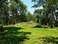
Ruin of the Vorburg Wenigenburg
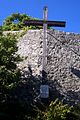
Ostland cross on the Amöneburg

Wide view from the Amöneburg


traffic
The B 62 ( Biedenkopf - Alsfeld ) (with a branch to the B 454 to Schwalmstadt ) and the B 3 in the direction of Marburg run a little north of Amöneburg . The next train station is 5 km north of Amöneburg in Kirchhain on the Main-Weser-Bahn Frankfurt – Kassel.
Personalities
Personalities born in Amöneburg
- Johannes Ferrarius (around 1486 - 1558), religious scholar, lawyer and first rector at the University of Marburg
- Johann Balthasar Braun (1643 / 44–1688), lawyer and professor at the Benedictine University of Salzburg
- Karl Greib (1899–1976), CSU politician
- Eduard Schick (1906–2000), Bishop of Fulda from 1974 to 1982, born in Mardorf
- Kurt Nacken (1908–1964), politician
- Josef Mönninger (1919–2017), Catholic theologian, born in Rüdigheim
- Gerhard Soff (1949–2004), theoretical physicist
Personalities who lived or worked in Amöneburg
- Bonifatius (around 673-754 / 755), founded a monastery cell below Amöneburg Castle in 721 and began the Christianization of Upper Hesse from Amöneburg
- Poppo I. (Reichenbach) (? -1156), Burgrave of Amöneburg
- Justus Rang (1802-1859), judge, administrative officer and parliamentarian, was a judicial officer and 1st depositary at the Amöneburg Justice Office and judge at the Amöneburg District Court
- Ludwig Schick (* 1949), auxiliary bishop in Fulda 1998–2002, archbishop of Bamberg since 2002 , grew up in Mardorf, honorary citizen of Amöneburg
- Werner Kathrein (* 1953), cathedral dean in Fulda, attended the St. Johann Abbey School in Amöneburg. Grew up in Amöneburg ??
- Stefan Heck (* 1982), member of the Bundestag and CDU politician, member of the city council of Amöneburg and its head since 2011. grew up in Amöneburg-Mardorf
For personalities who were only students of the St. Johann Abbey School, see here .
Individual evidence
- ↑ Hessian State Statistical Office: Population status on December 31, 2019 (districts and urban districts as well as municipalities, population figures based on the 2011 census) ( help ).
- ↑ Hessenviewer (Geoportal Hessen) of the Hessian State Office for Soil Management and Geoinformation with property mapping ( information )
- ↑ The numbers come from myheimat.de and are compatible with the value referenced at this point in time for the Erfurtshausen district from: Village renewal plan Erfurtshausen , August 2011 (PDF; 4.2 MB)
- ↑ Handbook of Historic Sites in Germany, Hesse , 3rd revised edition, p. 11
- ↑ a b Michael Losse: The Lahn castles and palaces , pp. 43–48
- ^ The battle at the Brücker mill on September 21, 1762. Society for Hessian Military and Civil History e. V., October 21, 2003, archived from the original on October 5, 2003 ; Retrieved September 4, 2012 .
- ^ Federal Statistical Office (ed.): Historical municipality directory for the Federal Republic of Germany. Name, border and key number changes in municipalities, counties and administrative districts from May 27, 1970 to December 31, 1982 . W. Kohlhammer GmbH, Stuttgart and Mainz 1983, ISBN 3-17-003263-1 , p. 403 .
- ↑ a b c d e f Amöneburg, Marburg-Biedenkopf district. Historical local dictionary for Hessen. (As of March 23, 2018). In: Landesgeschichtliches Informationssystem Hessen (LAGIS).
- ^ Michael Rademacher: German administrative history from the unification of the empire in 1871 to the reunification in 1990. State of Hesse. (Online material for the dissertation, Osnabrück 2006).
- ↑ Wilhelm von der Nahmer: Handbuch des Rheinischen Particular-Rechts: Development of the territorial and constitutional relations of the German states on both banks of the Rhine: from the first beginning of the French Revolution up to the most recent times . tape 3 . Sauerländer, Frankfurt am Main 1832, OCLC 165696316 , p. 418 ( online at google books ).
- ↑ Latest news from Meklenburg / Kur-Hessen, Hessen-Darmstadt and the free cities, edited from the best sources. in the publishing house of the GHG privil. Landes-Industrie-Comptouts., Weimar 1823, p. 158 ff . ( online at HathiTrust's digital library ).
- ↑ Ordinance on the constitution of the courts in the former Electorate of Hesse and the formerly Royal Bavarian territories with the exclusion of the enclave Kaulsdorf from June 19, 1867. ( PrGS 1867, pp. 1085-1094 )
- ↑ Order of August 7, 1867, regarding the establishment of the according to the Most High Ordinance of June 19 of this year. J. in the former Electorate of Hesse and the formerly Royal Bavarian territorial parts with the exclusion of the enclave Kaulsdorf, courts to be formed ( Pr. JMBl. Pp. 221–224 )
- ^ Local elections 1972; Relevant population of the municipalities on August 4, 1972 . In: The Hessian Minister of the Interior (ed.): State Gazette for the State of Hesse. 1972 No. 33 , p. 1424 , point 1025 ( online at the information system of the Hessian state parliament [PDF; 5.9 MB ]).
- ↑ Local elections 1977; Relevant population figures for the municipalities as of December 15, 1976 . In: The Hessian Minister of the Interior (ed.): State Gazette for the State of Hesse. 1976 No. 52 , p. 2283 , point 1668 ( online at the information system of the Hessian state parliament [PDF; 10.3 MB ]).
- ^ Local elections 1985; Relevant population of the municipalities as of October 30, 1984 . In: The Hessian Minister of the Interior (ed.): State Gazette for the State of Hesse. 1984 No. 46 , p. 2175 , point 1104 ( online at the information system of the Hessian state parliament [PDF; 5.5 MB ]).
- ↑ local elections 1993; Relevant population of the municipalities as of October 21, 1992 . In: The Hessian Minister of the Interior (ed.): State Gazette for the State of Hesse. 1992 No. 44 , p. 2766 , point 935 ( online at the information system of the Hessian state parliament [PDF; 6.1 MB ]).
- ↑ Municipal data sheet : Amöneburg. (PDF; 222 kB) In: Hessisches Gemeindelexikon. HA Hessen Agency GmbH
- ↑ The population of the Hessian communities on June 30, 2010. (PDF; 552 kB) Hessisches Statistisches Landesamt, p. 11 , archived from the original on February 7, 2018 ; accessed on March 5, 2018 .
- ^ Result of the municipal election on March 6, 2016. Hessian State Statistical Office, accessed in April 2016 .
- ^ Hessian State Statistical Office: Result of the municipal elections on March 27, 2011
- ^ Hessian State Statistical Office: Result of the municipal elections on March 26, 2006
- ^ Direct elections Amöneburg, city. (No longer available online.) In: Statistics.Hessen. Hessian State Statistical Office , formerly in the original ; accessed on June 4, 2018 . ( Page no longer available , search in web archives ) Info: The link was automatically marked as defective. Please check the link according to the instructions and then remove this notice.
- ^ Thomas Klein: The Hessians as Reichstag voters, first volume: Province of Hessen-Nassau and Waldeck-Pyrmont 1867-1933. 1989, ISBN 3-7708-0924-6 , p. 268.
- ^ Museum Amöneburg on the city's website; accessed in April 2017.
- ↑ Amöneburg in the GPS hiking atlas.
- ↑ Core city on the website of the city of Amöneburg.
- ^ Robert Berhorst: Amöneburg and Bonifatius (Wynfrith / Winfrid). August 14, 2007, archived from the original on August 19, 2007 ; Retrieved September 4, 2012 .
- ^ Mardorf on the website of the city of Amöneburg.
- ↑ Basalt columns of the Amöneburg geotope on the Vogelsberg geopark website.
- ↑ Brießelserlen nature reserve in the GPS hiking atlas .
literature
- Literature about Amöneburg in the Hessian Bibliography
- Search for Amöneburg (Hessen) in the archive portal D of the German Digital Library
Web links
- Internet presence of the city of Amöneburg
- Amöneburg, Marburg-Biedenkopf district. Historical local dictionary for Hessen. In: Landesgeschichtliches Informationssystem Hessen (LAGIS).
- Amöneburg (municipality), Marburg-Biedenkopf district. Historical local dictionary for Hessen. In: Landesgeschichtliches Informationssystem Hessen (LAGIS).
- Information on the community of Amöneburg. In: Hessisches Gemeindelexikon. HA Hessen Agentur GmbH , 2016.
- Erik Damm: Pictures of Amöneburg (taken from Schweinsberg Castle)
- Link catalog on Amöneburg at curlie.org (formerly DMOZ )

Amöneburg | Fishing castle | Bad Endbach | Biedenkopf | Breidenbach | Cölbe | Dautphetal | Ebsdorfergrund | Fronhausen | Gladenbach | Kirchhain | Lahn valley | Lohra | Marburg | Munchausen | Neustadt (Hessen) | Rauschenberg | Stadtallendorf | Steffenberg | Weimar (Lahn) | Weather (Hessen) | Wohratal