Greimuth
| Greimuth | ||
|---|---|---|
|
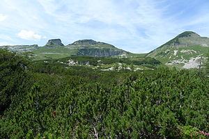
View of Hochanger (far left) - Atterkogel - Greimuth - Bräuningzinken (right) |
||
| height | 1871 m above sea level A. | |
| location | Altaussee , Styria , Austria | |
| Mountains | Dead Mountains | |
| Dominance | 0.9 km → Bräuningzinken | |
| Notch height | 121 m ↓ Gschwandsattel between Greimuth and Bräuningzinken | |
| Coordinates | 47 ° 40 '10 " N , 13 ° 47' 6" E | |
|
|
||
| rock | Tressenstein lime | |
| Age of the rock | Upper Jurassic | |
| Development | Loser panorama road | |
The Greimuth is an 1871 m above sea level. A. high summit in Ausseerland in Styria . Along with the Bräuningzinken, it forms the second highest elevation of the Augstkamm in the Dead Mountains and lies between the Bräuningzinken in the north and the Hochanger or Loser in the south. To the west, the mountain, made of Tressenstein limestone from the Upper Jura, is shaped by the steep drop to the Gschwandalm and the Rettenbachtal. In the east, the striking Atterkogel is in front of Greimuth, which is inconspicuous from here.
Development
On the 9 km long Loser Panorama Road , opened in 1972, the mountain can be driven almost to the top. There is a spacious parking lot in front of the Loser restaurant at 1600 m from which several tours can be undertaken. At 1643 m , in the immediate vicinity of the restaurant, there is the Augstsee - an attractive hiking destination with a short walking time.
Approaches
- From the Loser mountain restaurant, the marked path no. 256 leads past the Augstsee towards Loserfenster and Hochanger. Even before the Loser window, a narrow, unmarked trail branches off to the north a little west of the Augstsee without a sign and leads to the summit at 1871 m in 20 minutes . Walking time around an hour.
- From the northern Gschwandsattel, where hiking trail no. 257 runs from the Bräuningalm to the Bräuningzinken, there is no continuous path to the Greimuth. The ascent of the mountain is only possible for sure-footed and experienced hikers in partially pathless terrain.
A summit book is available at the summit of Greimuth.
Literature & Maps
- Wolfgang Heitzmann: Salzkammergut with the Totem Mountains and Dachstein: high-altitude trails, summit tours, via ferratas . Tour No. 45, pp. 178-181. New edition Bruckmann Verlag, Munich 2002, ISBN 3-7654-3336-5 .
- Alpine Club Map Bl. 15/1 (Totes Gebirge - West), 1: 25,000; Austrian Alpine Club 2014; ISBN 978-3-928777-29-2 .
- ÖK 50, sheet 96 (Bad Ischl)
Web links
Individual evidence
- ↑ alpintouren.com: Greimuth - Atterkogel - hiking tour. Retrieved October 10, 2014 .


