Gubrist (mountain)
| Gubrist | ||
|---|---|---|
|
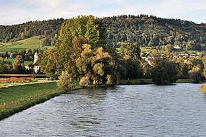
Gubrist with Fahr and Limmat Monastery |
||
| height | 615 m above sea level M. | |
| location | Municipality of Regensdorf , Canton of Zurich , Switzerland | |
| Dominance | 2.4 km → Altberggrat | |
| Notch height | 78 m ↓ Flur Folenmoos ( Weiningerpass ) | |
| Coordinates | 676 984 / 252891 | |
|
|
||
| rock | Marl and marl sandstone | |
| particularities | highest elevation of Regensdorf, Unterengstringen and Oberengstringen | |
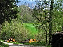
The Gubrist , formerly Guberist , is 615 m above sea level. M. high wooded mountain in the canton of Zurich . The eastern branch of the Altberg rises above Regensdorf in the Furttal in the north and Unterengstringen in the Limmattal in the south. Zurich's local mountains Hönggerberg and Käferberg connect to the east of the Gubrist .
The highest elevation of the Gubrist lies in the municipality of Regensdorf and represents its highest point. The southern slopes of the hill, however, also represent the highest points of Oberengstringen and Unterengstringen. Parts of the western slope belong to the municipality of Weiningen .
The exhaust chimney of the Gubrist tunnel on the A1 / A4 , which leads through the mountain, is located near the center . The tower is 32.4 meters high and its red signal light can be seen from a great distance in the dark. The ventilation for venting the tunnel via the ventilation shaft is no longer in operation today; air is only expelled via the exhaust chimney in the event of an incident (e.g. in the event of a fire).
The 537 m above sea level leads across the valley of the Folenmoosbach between Gubrist and Altberg . M. high Winiger (Weiningerpass), which connects Weiningen with Regensdorf.
swell
- Geoserver of the Swiss Federal Administration
- Federal Roads Office (FEDRO), Winterthur


