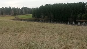
Hachtsee
| Hachtsee | ||
|---|---|---|

|
||
| Hachtsee | ||
| Geographical location | Obersöchering municipality , Weilheim-Schongau district , Upper Bavaria , Germany | |
| Drain | Steinbach / Ostersee-Ach → Starnberger See → Würm → Amper → Isar → Danube → Black Sea | |
| Location close to the shore | Obersöchering | |
| Data | ||
| Coordinates | 47 ° 44 '52 " N , 11 ° 15' 6" E | |
|
|
||
| Altitude above sea level | 665 m | |
| surface | 4.5 km² | |
| length | 465 m | |
| width | 115 m | |
| scope | 1.07 km | |
The Hachtsee is a natural still water in the Upper Bavarian municipality of Obersöchering . It belongs to the FFH area moorland and drumlin landscape between Hohenkasten and Antdorf .
The wilderness of the same name with a stud farm and the hamlet of Reinthal are located near the Hachtsee .
Web links
- Hachtsee in the Bavaria Atlas
Individual evidence
- ↑ Moor and drumlin landscape between Hohenkasten and Antdorf . In protectedplanet.net , accessed on July 6, 2018.
- ↑ Hachtsee Stud. In turf-times.de , accessed on July 6, 2018
