Hagenberg (Vienna)
| Hagenberg | ||
|---|---|---|
|
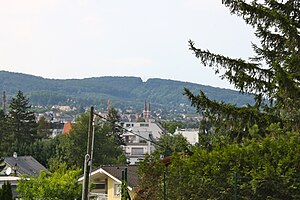
View from the rose hill to the wooded Hagenberg |
||
| height | 406 m above sea level A. | |
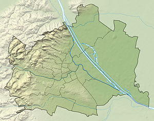
| location | Vienna , Austria | |
| Mountains | Vienna Woods | |
| Coordinates | 48 ° 11 '22 " N , 16 ° 14' 53" E | |
|
|
||
The Hagenberg is a 406 meter high, wooded mountain in the 13th district of Hietzing in Vienna .
geography
The Hagenberg is located in the northern part of the Hietzing district near the two old town centers of Ober Sankt Veit and Hacking . The mountain belongs to the Lainzer Tiergarten . In the immediate vicinity of the mountain lie the Nikolaiberg in the north and the Johannser Kogel in the west . In the west and south, the Hagenberg is bounded by the Schallautzergraben , which flows into the Grünauer Bach . The mountain is part of the Vienna Woods Mountains , the northeasternmost foothills of the Eastern Alps .
Origin of name
The Hagenberg is documented for the first time in 1377 as Hekenperg . Sometimes the reed name was also called Vorderer or Hinterer Hagenberg. Probably the name does not come from the word Hag , but has its roots in the nearby village of Hacking . Vineyards were also mentioned several times on the Hagenberg, but today there are no more vines here .
literature
- Heinrich Weigl: Historical place names book of Lower Austria . Association for regional studies of Lower Austria and Vienna, 1964–1965.
- Margarete Platt: The field names in the 10th, 12th and 13th districts of Vienna and in Inzersdorf . Dissertation, Vienna 1997.

