Hankenüll
| Hankenüll | ||
|---|---|---|
|
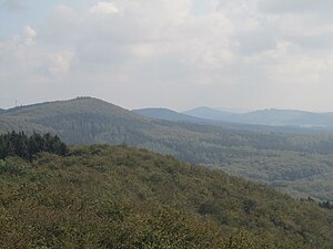
View from the Dissen telecommunications tower (Steinegge) southeast |
||
| height | 307 m above sea level NHN | |
| location | at Dissen and Borgholzhausen ; District of Osnabrück , Gütersloh ; Lower Saxony , North Rhine-Westphalia ( Germany ) | |
| Mountains | Teutoburg Forest | |
| Coordinates | 52 ° 7 '18 " N , 8 ° 14' 48" E | |
|
|
||
The Hankenüll is about 307 m above sea level. NHN high mountain in the Teutoburg Forest . It lies between Dissen and Borgholzhausen in the district of Osnabrück and the district of Gütersloh on the border of Lower Saxony and North Rhine-Westphalia ( Germany ). The name Hankenüll means "high peak".
geography
location
The Hankenüll rises in the middle part of the Teutoburg Forest in the nature and geopark TERRA.vita . The summit of the wooded elevation is 3 km east-northeast of Dissen and 4.3 km northwest of Borgholzhausen. The Hase tributary of the Ems rises to the northeast and the Aabach tributary to the south of the Hessel .
Natural allocation
The Hankenüll belongs in the natural spatial main unit group Lower Weserbergland (No. 53), in the main unit Osnabrücker Osning (534) and in the subunit Tecklenburger Osning (main ridge; 534.2) to the natural area Dissener Osning (534.22). The landscape falls to the north into the natural area of Vessendorfer Heights (534.11), which belongs to the subunit Tecklenburg-Ibürger Bergland (northern slope; 534.1) , and to the south into the natural area of Rothenfelder Osningvorland (534.32), which belongs to the subunit Southern Osningvorland (southern slope; 534.3).
Protected areas
Parts of the landscape protection areas Teutoburg Forest ( CDDA -Nr. 329212; designated 2004; 113.699 km² ; north side, district of Osnabrück) and Teutoburg Forest (CDDA-No. 555552763; 1972; 12.8277 km²; south side, district of Gütersloh) lie on the Hankenüll . as well as those of the fauna-flora-habitat areas Teutoburg Forest, Kleiner Berg (FFH no. 3813-331; 22.9446 km²; north side) and Eastern Teutoburg Forest (FFH no. 4017-301; 53.12 km²; north side ).
Individual evidence
- ↑ a b c Map services of the Federal Agency for Nature Conservation ( information )
- ↑ "Hankenüll" simply means: High summit , Neue Osnabrücker Zeitung, from March 19, 2015, on noz.de.


