Harrisburg Covered Bridge
Coordinates: 35 ° 51 ′ 39 " N , 83 ° 28 ′ 57" W.
| Harrisburg Covered Bridge | ||
|---|---|---|
| Harrisburg Covered Bridge (2006) | ||
| Crossing of | East Fork Little Pigeon River | |
| place | east of Sevierville ( Tennessee ) | |
| completion | 1875 | |
| location | ||
|
|
||
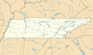
The Harrisburg Covered Bridge (also known as Pigeon River Covered Bridge , East Fork Bridge or McNutts Bridge called) is a historic, covered road bridge in Sevier County , in the US state of Tennessee , in the United States . It is located east of Sevierville off US Highway 441 . The bridge, which is designed in the King Post Truss design, spans the East Fork Little Pigeon River .
history
Before the Harrisburg Bridge was built in 1875, the McNutts Bridge existed in the same place , which was washed away in a flood . In March of the same year, the Sevier County Court ordered a body to be used to conduct and organize the construction of a new bridge. Panel members were JH Frame , AE Murphy , and DW Howard . As was customary at the time, the local population contributed to the financing or supplied building materials, or worked as an assistant in the construction of the project. Voluntary donations totaled $ 50 with the county government contributing an additional $ 25.
Elbert Stephenson Early (1850–1917) was commissioned to head the new building project. The Early family settled in this area in the 1870s. Many of the family members were trained craftsmen , including carpenters , mill builders , locksmiths and engineers . Elbert participated in 1877, next to the bridge project, with 50 percent of the equity of Newport Mill by Alexander Umbarger . Umbarger was related to Elbert's wife Clementine (1843–1922).
In the late 19th century, Harrisburg's population grew and life in the area flourished due to the large number of mills and blacksmiths in the area . After a new bypass was built around Harrisburg in 1915 , the community slowly disappeared and many people moved away.
In 1952, the bridge with the aid of a bridge pillar of concrete , of the truss is secured stabilized.
In the 1970s, the overall state of the bridge had so deteriorated that she thought about tearing up the organization Daughters of the American Revolution through donations muster the necessary financial means to rehabilitate the bridge. It was also the organization that applied for the bridge to be included in the NRHP , which succeeded on June 10, 1975 (NRHP-ID 75001777).
In 1983 the bridge was repaired again, but it was noted on the bridge that the passage for vehicles must not exceed the permissible total weight of three tons .
In 2004, various repairs were carried out on the bridge. After this further renovation , the gross vehicle weight was increased to 15 tons. The average crossing of vehicles per day is 20 (as of 2010).
The span of the bridge is 19.5 meters, the total length 26.9 meters, the inner width 3.2 meters. The building material for the walls consists partly of tinplate .
Web links
- Harrisburg Covered Bridge in the Geographic Names Information System of the United States Geological Survey
Individual evidence
- ↑ NRIS
- ^ Covered Bridges in Tennessee - Tennessee Department of Transportation
- ↑ History of Sevier County Tennessee ( Memento of the original from September 7, 2011 in the Internet Archive ) Info: The archive link was inserted automatically and has not yet been checked. Please check the original and archive link according to the instructions and then remove this notice.

