Hengduan Shan
| Hengduan Shan | ||
|---|---|---|
| Highest peak | Gongga Shan ( 7556 m ) | |
| location |
Sichuan , Tibet , Yunnan ( PR China ), Myanmar |
|
|
|
||
| Coordinates | 27 ° 0 ′ N , 100 ° 0 ′ E | |
| surface | 800,000 km² | |
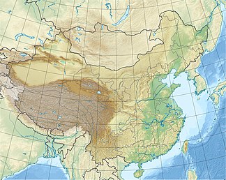
Hengduan Shan ( Chinese 橫斷 山 / 横断 山 , Pinyin Héngduàn Shān ), which is also called Hengduan Mountains ( 橫斷 山脈 / 横断 山脉 , Héngduàn Shānmài ), extends over an area of 800,000 km² in the southeast of the Tibetan highlands in China (Asia). Its main summit, Gongga Shan, measures 7556 m .
As the eastern continuation of the Himalayan mountain junction , Nyainqêntanglha with the partial chain of the Taniantawang Shan , this mountain range extends between the northern and eastern borders of Myanmar and over the extreme southeast of the Tibet Autonomous Region and the two Chinese provinces of Yunnan and Sichuan between 22 ° and 32 ° 05 ′ N and 97 ° and 103 ° E.
The most famous mountain ranges in the range are Gaoligong Shan , Nu Shan and Yun Ling , which separate the upper reaches of the Irrawaddy , Saluen , Mekong and Yangtze River .
Web links
- Biodiversity of the Hengduan Mountains on harvard.edu (English)
Individual evidence
- ↑ China's Hengduan Mountains ( Memento April 9, 2014 in the Internet Archive ). In: National Geographic Germany of April 1, 2002.
- ↑ China facts and figures 2004: The important mountains on german.china.org.cn, accessed on November 17, 2013.

