Irrawaddy
|
Irrawaddy Ayeyarwady, Ayeyarwaddy, Irrawadi |
||
|
Run, basin, and tributaries of the Irrawaddy |
||
| Data | ||
| location | Myanmar , Tibet ( PR China ) | |
| River system | Irrawaddy | |
| Confluence of |
Mali and N'mai in Kachin State 25 ° 42 ′ 0 ″ N , 97 ° 30 ′ 0 ″ E |
|
| Source height | 147 m | |
| muzzle | south of Henzada in the Gulf of Martaban ( Andaman Sea ) Coordinates: 15 ° 46 ′ 39 ″ N , 95 ° 3 ′ 49 ″ E 15 ° 46 ′ 39 ″ N , 95 ° 3 ′ 49 ″ E |
|
| Mouth height | 0 m | |
| Height difference | 147 m | |
| Bottom slope | 0.07 ‰ | |
| length | 2170 km (total length with source river) | |
| Catchment area | 413,674 km² | |
| Drain |
MQ |
13,000 m³ / s |
| Left tributaries | Taping , Shweli , Myitnge | |
| Right tributaries | Mu , Chindwin | |
| Big cities | Mandalay | |
| Navigable | approx. 1400 km | |
|
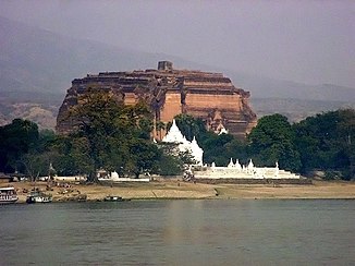
Mingun Temple on the Irrawaddy |
||
The 2170 kilometer long Irrawaddy , also Irawadi ( Burmese ဧရာဝတီ), more recent transcription Ayeyarwady or Ayeyarwaddy , is a river in Southeast Asia .
River course
Its longest source river - the Tarong - has its source in Zayü County in the Nyingchi administrative district of the Tibet Autonomous Region of the People's Republic of China , in the southeast of the Himalayas around 380 kilometers north of the city of Myitkyina in the Kachin State of Myanmar (Burma). There its source lies between the 4097 m high Tilala Pass and the 4663 m high Namnipass . Its water first flows a little bit in a south-easterly direction on Chinese territory and then finally reaches Myanmar, whose most important lifeline is the Irrawaddy. At the common border of the two countries and also in the north of Myanmar, it flows through the narrow valleys of the high mountains to later meander south in the lowlands over Mandalay ; in a north-south direction it divides Myanmar in half. Its largest tributary, the Chindwin , flows into it about 100 kilometers southwest of Mandalay .
Finally the Irrawaddy reaches the Gulf of Martaban , which belongs to the Andaman Sea , south of Henzada ; this is a marginal sea of the Indian Ocean . In its estuary that about 150 to 180 kilometers from located southwest Rangoon , the former capital of Myanmar, is, the river forms an approximately 40,000 sq km large estuary , which is primarily a rice growing area used and sediment deposits per year up to 60 meters in the Andaman Sea is pushed out.
Catchment area and navigability
The Irrawaddy, whose catchment area covers around 413,674 km², is navigable all year round from the estuary delta upstream over a length of around 1,337 kilometers to Bhamo in the north-central part of Myanmar.
Dam project
Burma and China wanted to build a huge dam ( Myitsone Dam ). On September 30, 2011, the Burmese government surprisingly announced the stop of the project.
The mirror wrote:
“The decisive factor behind President Thein Sein's surprising decision to stop construction was apparently a secret 900-page report on the risks of the mega-dam on the Irrawaddy, which came to the public in mid-September through targeted indiscretion - ironically, probably by Chinese scientists. Since then, the dispute over the dam had escalated into a litmus test for reform and democratization in Burma. It also fueled the simmering discussion about China's influence on the poor neighboring country with its many raw materials. "
Villages and towns on the Irrawaddy
See also
literature
- Kira Salak: Irawadi - river of spirits. A journey by kayak on Myanmar's great, mythical river. In: National Geographic Germany. May 2006, pp. 128-149.
Web links
Individual evidence
- ↑ one of the largest dams in the world should be built near the border between Burma and China spiegel-online October 2, 2011
- ↑ [1]

