Herrnsheimer Klauern
The Herrnsheimer Klauern are a forest area in the north of the city of Worms , east of the Herrnsheim district . The alluvial forest relic covers an area of around 80 ha.
description
The Herrnsheimer Klauern are an elongated, 4 km long and 0.5 km wide forest strip that runs between the Herrnsheim bathing lake and the city limits of Osthofen in the hollow of a former arm of the Rhine . In this trough collects backwater , which occurs in some places in the source pools to light.
75% of the forest area is owned by the State of Rhineland-Palatinate as a state forest . The area is now covered by mixed deciduous forest, remnants of alluvial forest are only found on partial areas. Typical tree species are common ash , common oak , hornbeam , sycamore maple , bird cherry and white elm .
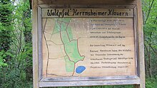
Located in the poorly forested Rheinhessen, the Herrnsheimer Klauern mainly serve for local recreation and nature conservation, the forestry use is in the background. In the southern part of the forest there is a 3.8 km long educational forest trail that starts at the parking lot of the swimming lake.
history
In the Palatinate dialect, “Klauer” means “swampy meadow land with sour grasses, made up of willows, poplars, alders” or “very wet field tub”. In the German dictionary a derivation of the Middle Latin clautrum, clautrus (grid, railing) is suspected. The South Hessian field name book gives the meaning of "willow planting"; Klauer is derived from Old High German kliuwa (knot, ball, ball) via Middle High German kliuwe, klûwe (knot, ball) and refers to the bulbous shape of the cut willow tree heads. The frequency of the name in Rheinhessen suggests a planned willow culture.
Until 1870, the Klauern as a private forest belonged to numerous, mostly rural owners from Herrnsheim. From 1870 the Heyl zu Herrnsheim family acquired a large part of the area in order to create a contiguous hunting area in the immediate vicinity of their residence in Herrnsheim Castle . Forest use only took place very irregularly.
By deepening the trenches in the area around 1935, the area was drained and made more accessible. During and after the Second World War, the lack of fuel meant that large parts of the stealers were cleared. Because of the still high groundwater level, fast-growing poplars were planted on the clearings until the groundwater level was lowered considerably in the 1970s through drainage measures, water extraction for field irrigation and for commercial purposes. Drought damage and vermin infestation led to large-scale death of poplar and pedunculate oak stands; by 1995 the stocks had to be completely felled on an area of around 40 hectares. Another 10 hectares were severely damaged by wind breakage in 1990.
In 2002 the state of Rhineland-Palatinate bought a large part of the Herrnsheimer Klauern. The development goal since then has been the creation of a species-rich mixed deciduous forest that is appropriate to the location and characterized by hardwoods .
Individual evidence
- ↑ a b c Landesforsten Rheinland-Pfalz , accessed on May 2, 2014
- ↑ Palatinate Dictionary , Vol. 4, Col. 281 f.
- ↑ German Dictionary , Vol. 11, Sp. 1034 f.
- ↑ Stealer. South Hessian field name book. In: Landesgeschichtliches Informationssystem Hessen (LAGIS).
- ↑ Landesforsten Rheinland-Pfalz: Herrnsheimer Klauern , accessed on February 1, 2012
Coordinates: 49 ° 39 ′ 48 ″ N , 8 ° 20 ′ 21 ″ E

