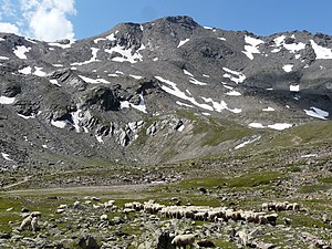
Rear Schöntaufspitze
| Back Schöntaufspitze Punta Beltovo di Dentro |
||
|---|---|---|
|
The rear Schöntaufspitze from the rear Madritschtal, the Madritschjoch can be seen on the left. |
||
| height | 3325 m slm | |
| location | South Tyrol , Italy | |
| Mountains | Ortler group | |
| Coordinates | 46 ° 30 '10 " N , 10 ° 37' 43" E | |
|
|
||
| First ascent | August 1865 by Edmund Mojsisovics and Sebastian Janiger | |
| Normal way | South ridge of the Madritschjoch | |
The Hintere Schöntaufspitze ( Italian Punta Beltovo di Dentro ) is a mountain near Sulden in the South Tyrolean Ortler Alps . It reaches a height of 3325 m slm and is part of the Stilfserjoch National Park .
The completely ice-free summit structure, which can be reached via a short detour from the marked path to the Madritschjoch, makes the Hintere Schöntaufspitze one of the higher “hiking peaks” in the Eastern Alps.
From the Schaubachhütte ( 2601 m ), which is not far from the mountain station of the Suldner Bergbahnen, the ascent takes about two hours. From the end of the road in the rear of the Martell valley, you can reach the Hintere Schöntaufspitze in just under three hours.
From the top you have a view on Königsspitze , Monte Zebru and Ortles and the Cevedale massif and the surrounding mountains above the Suldental and the Martell Valley .
literature
- Peter Holl: Alpine Club Guide Ortleralpen . Bergverlag Rudolf Rother, Munich 1990. ISBN 3-7633-1313-3


