Hořina (Radbuza)
|
Hořina Horschina |
||
|
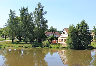
Pond on the Hořina in Černovice |
||
| Data | ||
| Water code | CZ : 1-10-02-073 | |
| location | Czech Republic | |
| River system | Elbe | |
| Drain over | Radbuza → Berounka → Moldau → Elbe → North Sea | |
| source | in Velký Malahov 49 ° 37 ′ 25 ″ N , 12 ° 57 ′ 20 ″ E |
|
| Source height | 505 m nm | |
| muzzle | southwest of Hradec in the Radbuza coordinates: 49 ° 37 ′ 37 " N , 13 ° 6 ′ 33" E 49 ° 37 ′ 37 " N , 13 ° 6 ′ 33" E |
|
| Mouth height | 340 m nm | |
| Height difference | 165 m | |
| Bottom slope | 13 ‰ | |
| length | 12.5 km | |
| Catchment area | 58.3 km² | |
| Drain |
MQ |
200 l / s |
The Hořina (German Horschina , also Horzina ) is a left tributary of the Radbuza in the Czech Republic .
course
The Hořina rises in Velký Malahov in the foothills of the Sedmihoří ( Seven Mountains ). Its source is in the pond on the Velký Malahov village square. The Hořina flows on its upper course with an easterly direction between Ostromeč and Jivjany through to Černovice . The stream then forms a gentle valley in the Staňkovská pahorkatina ( Stankauer hill country ) and flows in a north-easterly direction past the hill Dvanáctka (475 m nm) to Hradišťany. There, the stream on the spur Radlštejn (turns Radel stone ) first rugged southeast. The further course of the Hořina leads in an easterly direction through an unpopulated, partly rocky Kerbtal past Honezovice and Lisov along the northern edge of the Horzina forest. There are holiday home settlements at the lower reaches of the stream. Shortly before its mouth, the stream becomes part of the Plzeň – Furth railway in the forest . After 12.5 kilometers, the Horina flows south-west and a half kilometers Hradec at the northeastern foot of Horina ( Horzina , 408 m nm) into the Radbuza . Its catchment area is 58.3 km².
Tributaries
- Skapecký potok (l), in Hradišťany
- Nedražický potok (l), near Honezovice
