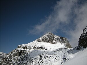
Hockenhorn
| Hockenhorn | ||
|---|---|---|
|
Summit pyramid of the Hockenhorn |
||
| height | 3292 m above sea level M. | |
| location | Border canton Bern / canton Wallis , Switzerland | |
| Mountains | Bernese Alps | |
| Dominance | 3.5 km → Balmhorn | |
| Notch height | 348 m ↓ Märbiglücke | |
| Coordinates | 623 484 / 141945 | |
|
|
||
| First ascent | August 1840 by Arthur Thomas Malkin | |
The Hockenhorn is a 3292 m high peak north of the Lötschental on the border between the cantons of Bern and Valais in Switzerland .
The first ascent by the Englishman Arthur Thomas Malkin took place in August 1840 . Today the Hockenhorn is an easy-to-climb summit for experienced mountain hikers with a view of a large part of the Valais Alps up to Mont Blanc .
Access is from the south from the Lötschental, from the north from the Gasterntal (Kandersteg) over the Lötschenpass or from the Lauchernalp from the south / south-east over the Mühlebach glacier to the summit ascent. The last section leads from the point in the northwest (ski depot for ski tours) over light gravel in a staircase-like manner to the summit.

