
Hohe Loog House
| Hohe-Loog-Haus PWV hut |
||
|---|---|---|
 Hohe Loog House |
||
| location | Haardt (Palatinate Forest) ; Neustadt an der Weinstrasse - Südliche Weinstrasse district , Rhineland-Palatinate | |
| Mountain range | Palatinate Forest | |
| Geographical location: | 49 ° 19 '57.1 " N , 8 ° 5' 41.1" E | |
| Altitude | 614 m above sea level NN | |
|
||
| owner | Palatinate Forest Association | |
| Construction type | Hut; Sandstone | |
| Usual opening times | Wednesday, Saturday, Sunday + public holidays | |
| accommodation | 0 beds, 0 camps | |

The Hohe-Loog-Haus , also called Hambacher Hütte , is a managed refuge of the Hambach local association of the Palatinate Forest Association in the Palatinate Forest . It is located on the summit of the Hohen Loog ( 619 m ) in the Haardt .
location
The hut is located about 100 meters west of the Hohe Loog summit. While no view is possible from the wooded summit, there is an excellent view of the Kalmit massif and the Rhine plain from the hut . The hut is at an altitude of 614 m .
Access and walks
The hut can only be reached on foot via hiking trails. The shortest access starts from the hiking car park on Kalmithöhenstraße at Hahnenschritt over the Zwergberg . The ascents from the Rhine valley are made from Maikammer via the Klausental or the Alsterweiler Valley or from Neustadt via the Kaltenbrunner Valley also via the Hahnenschritt. Direct access is possible from Neustadt via the Nollensattel and the Hohe-Loog level. Starting from Hambach Castle , the hut can also be reached via the Sommerberg as a foothill of the Hohen-Loog. Finally, the hut can also be reached from the hiking car park on the Kalmit via Hahnenschritt. The various ascent options (and the resulting descent variants) can easily be combined into circular routes. The neighboring huts of the Palatinate Forest Association are the Kalmithaus , the Klausentalhütte and the Hellerhütte .
Picture gallery

Hohe Loog House

Hohe-Loog-Haus - outdoor area
Hohe-Loog-Haus - information board

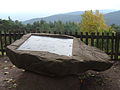
Hohe-Loog-Haus - anniversary stone


literature
- AK Doerr: Palatinate Hüttenbuch - The guide to 99 rest houses and hikers' homes . Pfälzische Verlagsanstalt Ludwigshafen GmbH, 4th edition June 2018, ISBN 978-3-87629-341-7 , p. 128.
- State Office for Surveying and Basic Geographic Information Rhineland-Palatinate - topographic map 1: 25000 - Palatinate Forest Nature Park, sheet 6 Oberhaardt from Neustadt an der Weinstrasse to Queichtal 2010, ISBN 978-3-89637-402-8 .
- Pietruska hiking map: Edenkoben - the holiday region between Landau and Neustadt. 1: 25000, 3rd edition, Pietruska Verlag, Rülzheim 2018, ISBN 978-3-945138-04-5 .
- Rother Wanderbuch Pfälzerwald and Deutsche Weinstrasse , Bergverlag Rother GmbH, Munich 2013, p. 68, ISBN 978-3-7633-3077-5 .
- Bruckmann hiking compact Pfälzerwald with Bienwald , Bruckmann verlag GmbH, Munich, 2009, p. 73, ISBN 978-3-7654-4287-2 .
Web links
Individual evidence
- ^ LANIS: Topographic Map. Retrieved January 24, 2017 .