High cunning
| High cunning | ||
|---|---|---|
|
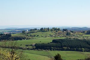
View from the Mäuseberg to the Hohen List with a hilltop of the Hoher List observatory between the trees |
||
| height | 549.1 m above sea level NN | |
| location | Vulkaneifel district , Rhineland-Palatinate , Germany | |
| Mountains | Vulkaneifel | |
| Coordinates | 50 ° 9 '42 " N , 6 ° 50' 55" E | |
|
|
||
| Type | Stratovolcano | |
| particularities | Location of the Hoher List observatory |
|
The Hohe List is 549.1 m above sea level. NN high stratovolcano near the town of Daun in the Eifel in the Vulkaneifel district in Rhineland-Palatinate ( Germany ).
Geographical location
The Hohe List is located in the Vulkaneifel , part of the Eifel, in the Vulkaneifel Nature Park . It is located about 4.5 km (depending crow flies ) south of the city down , just southwest of the Schalke Maar located Schalkenmehren .
Mountain description
The Hoher List observatory stands on the summit of its sparsely wooded knoll and the Altburg on its 540.1 m high, heavily wooded southwestern foothills .
To the west, past the summit of the Hohen Lists, runs within the Eifel-Ardennen-Strasse section of the state road 64, which connects Schalkenmehren in the north with Brockscheid in the south.
Individual evidence
- ↑ a b Map service of the landscape information system of the Rhineland-Palatinate Nature Conservation Administration (LANIS map) ( notes )


