Holtwick (Haltern am See)
|
Holtwick
City of Haltern am See
Coordinates: 51 ° 45 ′ 12 ″ N , 7 ° 7 ′ 57 ″ E
|
||
|---|---|---|
| Height : | 85 m | |
| Area : | 92.3 km² (Haltern parish) | |
| Residents : | 945 (Dec. 31, 2019) | |
| Population density : | 10 inhabitants / km² | |
| Postal code : | 45721 | |
| Area code : | 02364 | |
|
Location of Holtwick in North Rhine-Westphalia |
||
|
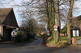
Street in Haltern-Holtwick
|
||
With 945 inhabitants (as of December 31, 2019), Holtwick in the southwest of Münsterland is the smallest district of the city of Haltern am See in the North Rhine-Westphalian district of Recklinghausen . There is a neighborhood that is called HoTaLü and consists of the districts of Holtwick, Tannenberg and Lünzum . The Tannenberg district is part of the Lippramsdorf village.
Geographical location
Holtwick is located in the Hohe Mark-Westmünsterland Nature Park , about 4 km (as the crow flies ) west-north-west of the center of the Haltern town center. To the northwest the landscape rises to the Waldbeerenberg ( 145.9 m ), the highest elevation of the Hohe Mark , and to the south it leads over to the Lippe, about 4 km away . The village is connected to Haltern via county road 5.
history
Holtwick is mentioned in a document as Holtwick juxta Holtwich juxta Halteren as one of the many possessions of the monastery in Werden around 1200 AD. For many centuries, Holtwick was just a peasantry , which over time also included the sub-farming communities Bergbossendorf (previously to Bossendorf ), Berghalter, Lünzum and Hennewig.
Because of its natural location, the painter Hermann Moog settled in Holtwick in 1934 and later built a studio and house.
The place belonged to the municipality of Kirchspiel Haltern until it was incorporated into Haltern on January 1, 1975.
traffic
Holtwick can be reached via the trunk road network via the A 43 Wuppertal - Münster exit Haltern .
Individual evidence
- ↑ Facts and Figures | City of Haltern am See. Retrieved March 16, 2020 .
- ^ Federal Statistical Office (ed.): Historical municipality directory for the Federal Republic of Germany. Name, border and key number changes in municipalities, counties and administrative districts from May 27, 1970 to December 31, 1982 . W. Kohlhammer, Stuttgart / Mainz 1983, ISBN 3-17-003263-1 , p. 316 .

