Holzer Bach (Wupper)
| Holzer Bach | ||
|
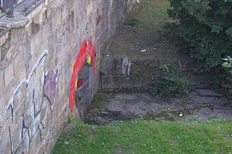
The confluence of the Holzer Bach in the Wupper |
||
| Data | ||
| Water code | DE : 27365136 | |
| location | Wuppertal , North Rhine-Westphalia , Germany | |
| River system | Rhine | |
| Drain over | Wupper → Rhine → North Sea | |
| source | Near the Bergische University in Wuppertal 51 ° 14 ′ 46 ″ N , 7 ° 9 ′ 9 ″ E |
|
| Source height | 215 m above sea level NN | |
| muzzle | In Wuppertal- Elberfeld in the Wupper coordinates: 51 ° 15 ′ 19 ″ N , 7 ° 8 ′ 47 ″ E 51 ° 15 ′ 19 ″ N , 7 ° 8 ′ 47 ″ E |
|
| Mouth height | 143 m above sea level NN | |
| Height difference | 72 m | |
| Bottom slope | 63 ‰ | |
| length | 1.1 km | |
| Catchment area | 61,016.4 ha | |
| Big cities | Wuppertal | |
|
Tributaries and hydraulic structures
|
The Holzer Bach is a left tributary of the Wupper in the Elberfeld district of the North Rhine-Westphalian city of Wuppertal .
Location and topography
The Holzer Bach rises at 226 meters above sea level. NN east of the Bergische Universität in an allotment garden in the residential area of Grifflenberg . Shortly after the source, it is dammed in a small pond and disappears in a dole. Below Holzer Strasse , Querstrasse and Unterer Grifflenberg , it flows northwards past the Christ Church , crosses under the Düsseldorf – Elberfeld railway line to the west of Wuppertal Central Station and ends after about 1.1 kilometers at 141 meters above sea level. NN. on the banks of Iceland opposite the Mirker Bach in the Wupper .
Almost in its entire course the stream flows underground in an artificial hollow .
Individual evidence
- ^ German basic map 1: 5000
- ↑ Topographic map 1: 25,000
- ↑ a b River Area Geoinformation System of the Wupper Association (FluGGS Wupper)
