Mirker Bach
|
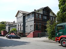
Mirker Bach in the upper reaches as Hohenhager Bach |
||
|
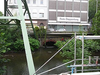
The mouth of the Mirker Bach into the Wupper |
||
| Data | ||
| Water code | DE : 2736514 | |
| location | Wuppertal , North Rhine-Westphalia , Germany | |
| River system | Rhine | |
| Drain over | Wupper → Rhine → North Sea | |
| source | In Wuppertal 51 ° 17 '43 " N , 7 ° 10' 39" E |
|
| Source height | 267 m above sea level NN | |
| muzzle | In Wuppertal in the Wupper coordinates: 51 ° 15 ′ 20 ″ N , 7 ° 8 ′ 46 ″ E 51 ° 15 ′ 20 ″ N , 7 ° 8 ′ 46 ″ E |
|
| Mouth height | 145 m | |
| Height difference | 122 m | |
| Bottom slope | 21 ‰ | |
| length | 5.9 km | |
| Catchment area | 7.804 km² | |
| Big cities | Wuppertal | |
|
Tributaries and hydraulic structures
|
|||||||||||||||||||||||||||||||||||||||||||||||||||||||||||||||||||||||||||||||||||||||||||||||||||||||||||||||||||||||||||
The Mirker Bach is a 5,894 meter long brook in the Wuppertal districts of Uellendahl-Katernberg and Elberfeld . The brook, which is a tributary of the Wupper , is named like the Mirker Hain and the Mirker Höhe after the Mirke area, which lies roughly at the confluence of the Vogelsangbach and Eschenbeek with the Mirker Bach. Since the 16th century at the latest there has been a “Mirke” genetic material around which yarn bleaching has been pursued.
topography
The Mirker Bach, whose upper course is not clearly identified, rises in the north of Wuppertal. The Wupperverband takes the 897 meter long Hohenhager Bach (occasionally also written as Hohenhagener Bach ) as the upper reaches of the Mirker Bach. This rises in the rural area near the district Dönberg . The Hohenhager Bach flows from the source in a south-westerly direction and after about 600 meters meets the Hatzfelder Bach , which flows into the brook from the left. After another 300 meters, the Hohenhager Bach joins the 889 meter long Hager Bach .
From around today's intersection of Dönberger Strasse and Uellendahler Strasse , it is called Mirker Bach and is 4998 meters long from here to the mouth. It now crosses under Dönberger Strasse , which then follows the course of the stream to the left, heading south. Shortly after crossing under , the Honsbuschsiefen , which previously filled a pond, flows into it on the right. At around 370 meters, the Mirker Bach flows through a brook landscape parallel to Uellendahler Straße until it crosses under Am Raukamp . Behind the commercial settlements on Uellendahler Strasse, it flows above ground on the northern edge of the ridge of Stübchensberg or Weinberg in a south-westerly direction. On the approximately 2,100-meter-long route, the 250-meter-long Zamenhofbach and the 818-meter-long stream on the Gebrannten come piped from the right .

At the end of the ridge, the Mirker Bach turns south and continues with the Uellendahler Straße piped on. It is still fed from the right by the 1251 meter long Vogelsangbach and also from the 1377 meter long Eschenbeek coming from the right . Behind a gas station it flows again for 90 meters above ground and then crosses under the federal motorway 46 (A 46). Although the motorway spans this valley with a bridge, the Mirker Bach continues piped and then crosses under the disused "Wuppertaler Nordbahn" . The Wuppertal-Mirke train station, which used to be Elberfeld's second main train station, is also close by.
The stream now runs underground to the mouth and follows Uellendahler Strasse , which turns into Gathe Street . Both streets are at the western foot of the Engelnberg . Before the Gathe in the Morianstraße passes, the piping of the Mirker creek runs to the southwest at Neumarkt over and runs below the pedestrian area of the Wall , where he the moat of medieval fortification castle Elberfeld dined. Here, near the headquarters of the Sparkasse Wuppertal , the Mirker Bach flows into the Wupper as a right tributary at 154 meters above sea level .
Remodeling 2011
In January 2011, work began on connecting the mouth of the Mirker Bach to the Wupper relief collector .
Etymologist and History
The name Mirker Bach is derived from Marker Bach, Markbach (= Grenzbach). The name characterizes the property as a high medieval border of the Free County of Volmarstein , which has been handed down from a border description from the 16th century.
In the 19th century, the Mirker Bach was, alongside the Wupper and the Barmer Mühlengraben, one of the most heavily polluted rivers in the Wuppertal. Numerous commercial and private sewage was discharged into the stream. On the occasion of one of the frequent cholera epidemics , the district physician Brisken commented on the Mirker Bach:
"[The Mirker Bach served] ... as a place of reception of all and every animal and human excrement not only, but also dogs, cats, all domestic vermin found a willing burial place in the same, in general everything was thrown into the open throat, which was just somehow superfluous in it Household could be viewed. "
In 1807 the mayor of Elberfeld, Abraham Frowein , ordered:
"Since so many complaints about the pouring of the room dung in the Wupper, the Mirker Bach, as well as in the alleys, garden paths and public places, this unlawful nonsense can no longer be looked up anyway - as if it was already there issued prohibitions repeatedly, and any such mischief with a penalty of 3 Reichstaler, or at best arrest penalty in case of inability, and that the rubble should be removed at his expense and that, and the police officer ordered to watch closely. "
In the course of the following years, the waste disposal in the Mirker Bach was pursued with strict punishment by the city police. The commercial discharge of waste water was excluded from this.
natural reserve
A 26 hectare area at the source area, which is also known as Hohenhager Bach, is designated as a nature reserve with the title: "Hohenhager Bachtal and Surroundings". The protection took place:
- For the preservation and development of the existing biotope complexes as a refuge and regeneration area for animal and plant species bound to wet locations
- To preserve a near-natural, locally significant river with typical river fauna
- Preservation of the structural wealth of the Bachtal with wet and wet grassland, spring meadows and fallow land, near-natural riparian trees made of alder, ash and willow as well as small forests with old wood
- For reasons of geography and because of the special nature of the culturally and historically significant structures with old hedges, paths and traces of historical use (kiln sites for the production of charcoal in the groves and slag finds)
Individual evidence
- ↑ a b German basic map 1: 5000
- ↑ a b river basin geographic information system of Wupperverbandes
- ↑ River Geographic Information System of Wupperverbandes .
- ^ Sewer construction under the Sparkasse Westdeutsche Zeitung (online) from January 7, 2011.
- ^ Underground sewer construction: Glückauf, where Thalia once shone Westdeutsche Zeitung (online) from January 16, 2011.
- ^ A b Florian Speer : When garbage celebrates its birthday ... 1906–1956 - 1976–2006 ; Festschrift for the triple anniversary 100 years of municipal waste collection, 50 years of system emptying, 30 years of the Hahnerberg waste incineration plant, Wuppertal, 2006
Web links
- Nature reserve “Mirker Bach” (W-011) in the specialist information system of the State Office for Nature, Environment and Consumer Protection in North Rhine-Westphalia
