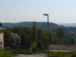
Stübchensberg
| Stübchensberg | ||
|---|---|---|
|
seen from Lembruch (Hainstrasse) |
||
| height | 271 m | |
| location | Wuppertal | |
| Mountains | Rhenish Slate Mountains | |
| Coordinates | 51 ° 16 '42 " N , 7 ° 10' 56" E | |
|
|
||
|
The surveys in Wuppertal |
||
The Stübchensberg is a 271 meter high, wooded ridge on the border of the Wuppertal districts of Elberfeld and Barmen .
topology
The ridge is located in the north of the geographical center of Wuppertal and extends in an east-west direction. The district of Uellendahl is to the north and the district of Clausen to the south . The Mirker Bach runs at the northern foot of the ridge and the Schönebeck at the southern . To the west is the neighboring Uellendahler Berg, which belongs to the ridge and on the western flank of which is the Jewish cemetery at the Weinberg .
The southern flank of the Stübchensberg is cut through by the federal motorway 46 , behind which lies the Helios Klinikum Wuppertal .
The city limits of the two formerly independent cities Elberfeld and Barmen , today the city district border between the Wuppertal districts of Uellendahl-Katernberg and Barmen , ran on the ridge .
legend
A legend is associated with the Stübchensberg . A gallows is said to have stood there on which an innocent man was executed. Immediately after the execution, the innocence was proven and the gallows was broken off immediately, the judge immediately resigned on the spot. The place of the gallows has always been damp since then, because the tears for the executed man well up there.
Individual evidence
- ↑ Otto Schell: Bergische Sagen , Baedeker, 1897


