Hope River (Canterbury)
| Hope River | ||
|
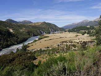
View to the east from SH 7 |
||
| Data | ||
| location | Hurunui District , Canterbury Region, New Zealand | |
| River system | Waiau River | |
| Drain over | Waiau River → Pacific Ocean | |
| source |
The Nelson Tops 42 ° 37 ′ 17 ″ S , 172 ° 5 ′ 58 ″ E |
|
| Source height | 1400 m | |
| muzzle | in the Waiau River coordinates: 42 ° 35 '37 " S , 172 ° 33' 38" E 42 ° 35 '37 " S , 172 ° 33' 38" E |
|
| Mouth height | 400 m | |
| Height difference | 1000 m | |
| Bottom slope | 22 ‰ | |
| length | 45 km | |
| Left tributaries | Boyle River | |
| Right tributaries | Kakapo Brook | |
|
View to the west from SH 7 near the bridge 980 |
||
|
Confluence: Waiau River (center) and Hope River (coming from left) |
||
The Hope River is a 45 km long river in the Hurunui District , in the north of the Canterbury region on the South Island of New Zealand .
geography
The headwaters of the Hope River is north of a 1651 m high mountain peak in The Nelson Tops . From there the Hope River flows mainly in an easterly direction and collects the water from numerous streams (smaller bodies of water) in its course . In addition, two rivers flow into the Hope River , the Boyle River coming from the north, which carries most of the water with its tributaries, and the Kakapo Brook from the south , which drains the Glynn Wye Range . After 45 km the Hope River flows north of the Organ Range into the Waiau River .
The New Zealand State Highway 7 runs through the lower valley of the Hope River , coming from the west coast of Reefton to the east coast to Waipara .
geology
The Hope Fault , a geological fault that was involved in the Kaikoura earthquake on November 14, 2016, runs through the valley of the Hope River .
use
The river, like the Waiau River, is good for fishing for brown trout along almost its entire length .
Individual evidence
- ↑ a b c Measurement of the length and the determination of the coordinates of the source and the mouth by Google Earth.
- ↑ a b Topo250 maps - Reefton - Wairau River - Lake Sumner . Land Information New Zealand , accessed February 7, 2017 .
- ↑ Hope River at SH7 . Land Air Water Aoteaora (LAWA), accessed February 7, 2017 .
- ^ Waiau River Fishing . nzfishing.com , accessed February 7, 2017 .


