
Hundstalkogel
| Hundstalkogel | ||
|---|---|---|
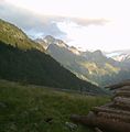
 Hundstalkogel from Moalandlsee (from the northwest) |
||
| height | 3080 m above sea level A. | |
| location | Tyrol , Austria | |
| Mountains | Ötztal Alps | |
| Dominance | 1.77 km → Reiserkogel | |
| Notch height | 254 m ↓ Sandjöchl | |
| Coordinates | 47 ° 1 '58 " N , 10 ° 53' 35" E | |
|
||
| First ascent | 1889 by F. Hörtnagl, L. Prochaska and F. Stolz | |

The Hundstalkogel is 3080 m above sea level. A. high mountain of the Geigenkamm , a mountain range of the Ötztal Alps . It is one of the three thousand meter peaks in the Pitztal that is furthest forward towards the valley and can be seen from far away from the front Pitztal. It shows the observer from the valley the shape of a mighty wedge with two huge rock shoulders on the right and left. Its straight-looking, sharp ridge carries two peaks. The 2948 m high north summit and the 3080 m high south summit. The south ridge has some deeply cut notches and continues in a slight curve to the southwest towards Sturpen . Its northwest shoulder carries the Schwarzkogel.
First ascent
The first ascent of the mountain was carried out in 1889 by F. Hörtnagl, L. Prochaska and F. Stolz. You climbed from the Sandjoch over the steep, blocky mountain ridge first to the north summit. Then they climbed over the difficult connecting ridge to the main summit. The descent took place over the south ridge and into the slab slopes of the Hundskar .
Routes
The ascent of the mountain is quite long on all routes because there are no suitable bases. The most common routes are:
- South flank: The easiest ascent leads from Trenkwald in the Pitztal over the Hundsbachalm. The marked trail can be used up to the Alm, which continues to the Breitlehnerjoch. At an altitude of a little over 2200 m you leave the trail and climb without a path in a north-easterly direction into the valley below the connecting ridge to Sturpen. A karst sill at about 2700 m can be climbed to the left of the rock bar on the left of the stream (I). After overcoming this steeper section of the valley, you soon reach the Hundskar basin. From there a clear, upwardly narrowing gully leads to the south ridge of the mountain. Then it goes in easy climbing (I, a few places II) over the ridge to the summit, whereby some more difficult ridge sections can be bypassed in the eastern flank. According to the literature, four hours are estimated for this increase.
- Normal route to the north summit: Via the Luibisalm to the Luibiskar. Now to the south under the Reiserscharte over to the Sandjoch ( 2826 m ). Straight up from the Sandjoch over the steep, blocky mountain ridge. In the upper part over flat rocks to the north summit with Steinmann.
- Transition from the north to the south: in 15 minutes you can get from the north to the south in exposed, moderately difficult climbing (II).

Hundstalkogel from the Pitztal
Hundstalkogel from the Pitztal with Schwarzkogel

Hundstalkogel from the Luibisscharte

Hundstalkogel from the Luibisalm. On the left the Schwarzkogel


literature
- Walter Klier : Alpine Club Guide Ötztaler Alpen , Bergverlag Rudolf Rother, Munich 2006. ISBN 3-7633-1123-8
- Ludwig Obersteiner: Guide through the Ötztal Alps , Reichenstein-Verlag, Vienna 1925