Husum Bay
Coordinates: 54 ° 28 ′ 34 ″ N , 8 ° 57 ′ 54 ″ E
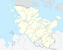
The Husum Bay is a bay in the North Sea that belongs to Schleswig-Holstein . The name is also used to market the holiday region around the city of Husum .
The bay is part of the Schleswig Holstein Wadden Sea National Park and has been declared a UNESCO World Heritage Site.
location
The landscape of the Eiderstedt peninsula begins in the south of Husum Bay, while the Schobüller Geest lies in the north . It is connected to the peninsula Nordstrand , from which the Adler Express connects to Sylt via Hallig Hooge . The river landscape of the rivers Eider , Treene and Sorge begins in the east . Well-known places are Husum with its districts and surrounding places up to the Südermarsch .
fauna
The Wadden Sea offers protection for migratory birds and, in addition to white fish, is home to the Schleswig Holstein waters of perch , pike , carp , asp , tench , catfish and pikeperch . On land you can find sheep and goats as natural lawnmowers on the dike .
Individual evidence
- ↑ Unesco World Natural Heritage Europe: Wadden Sea in Germany
- ↑ Holidays in the country at husum-tourismus.de
- ↑ Fishing on husum-tourismus.de

