Ilgenbach (Murg)
| Ilgenbach | ||
|
The Ilgenbach |
||
| Data | ||
| Water code | DE : 23614 | |
| location | Baden-Württemberg ; Germany | |
| River system | Rhine | |
| Drain over | Murg → Rhine → North Sea | |
| source | North of knee to 48 ° 29 '51.5 " N , 8 ° 16" 6.5 " E |
|
| Source height | approx. 920 m above sea level NN | |
| muzzle | north of Mitteltal in the Murg Coordinates: 48 ° 31 '31.6 " N , 8 ° 18' 22.1" E 48 ° 31 '31.6 " N , 8 ° 18' 22.1" E |
|
| Mouth height | 576 m above sea level NN | |
| Height difference | approx. 344 m | |
| Bottom slope | approx. 77 ‰ | |
| length | approx. 4.5 km | |
| Catchment area | approx. 5.026 km² | |
The Ilgenbach is a creek less than five kilometers long in the northern Black Forest , which flows into the upper Murg from the right in the Mitteltal suburb of the Baiersbronn municipality in the Freudenstadt district in Baden-Württemberg .
course
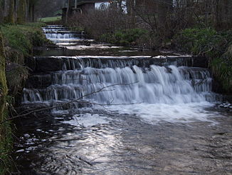
The headwaters of the Ilgenbach lies on the upper northern drop of the Kniebis at about 920 m above sea level. NN below a boggy plateau, between the summit of the Sperberhart ( 936.1 m above sea level ) in the northwest and the Black Forest high road running on the Kniebisrücke in the southwest. On the tight first kilometers of its legally valid northeastern run it deepens rapidly, and then tumbles over a series of four-high to 9 meters drop steps in one of glacial posthumous glaciers Kar , in whose name Bletschermüsse the near waterfall resonates. In this valley floor between the Sperberhart in the west and the Kniebis-Nordostsporn Rappenberg ( 883.7 m above sea level ) in the east, the stream becomes about 720 m above sea level. NN reinforced by several swelling channels.
The following run in a long, wooded valley has a lower gradient. At the foot of the elongated valley slopes in a spring horizon of the Lower Buntsandstein, the crevice and pore water of the accompanying high ridge with high rainfall emerges and reaches the Ilgenbach. After about 3.5 km it leaves at about 620 m above sea level. NN the valley forest and, accompanied by a gallery, runs next to the Ilgenbachstraße under now flatter slopes with remnants of meadow irrigation, between the Mitteltaler settlement areas Looch and Ilgenbach . In the creek bed, numerous construction steps reduce the erosion force of the creek during floods. Finally the Ilgenbach flows out at about 580 m above sea level. NN , opposite the bath of Baiersbronn-Halde, from the right into the upper Murg.
Individual evidence
- ↑ According to the contour line image on the Geoportal Baden-Württemberg ( information ).
- ↑ Labeling in blue at the mouth on the geodata viewer.
- ↑ a b State Institute for the Environment Baden-Württemberg (LUBW) ( information )
