
Imera Meridionale
| Imera Meridionale | ||
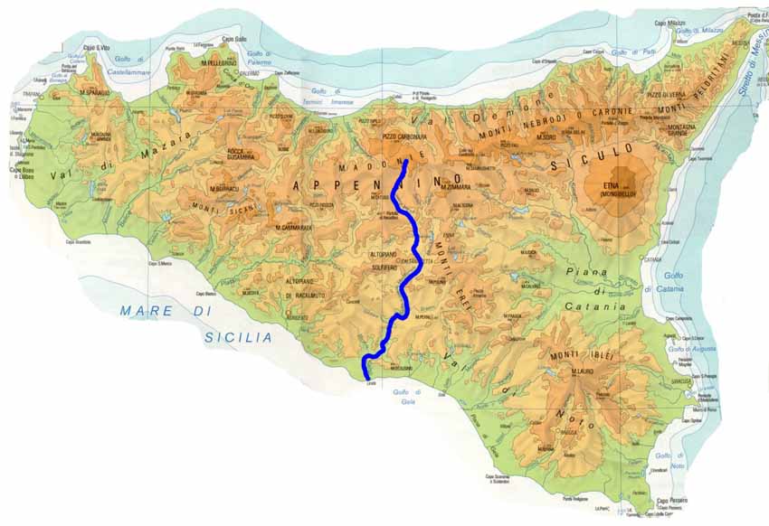
 Course of the Imera Meridionale |
||
| Data | ||
| location | Sicily | |
| River system | Imera Meridionale | |
| source | at Pizzo Catarineci in Monti Madonie 37 ° 49 ′ 46 ″ N , 14 ° 8 ′ 57 ″ E |
|
| Source height | approx. 1160 m slm | |
| muzzle | at Licata in the Mediterranean Coordinates: 37 ° 6 ′ 5 ″ N , 13 ° 56 ′ 49 ″ E 37 ° 6 ′ 5 ″ N , 13 ° 56 ′ 49 ″ E
|
|
| length | 144 km | |
The Imera Meridionale ( Italian for southern Imera ) is a river in Sicily . It flows into the Mediterranean Sea at Licata , which is called the Strait of Sicily there.
At 144 km it is the longest river on the island. It rises in the north of the same as Torrente Avanella on Pizzo Catarineci in the Monti Madonie and flows south through the metropolitan city of Palermo and the free municipal consortia Enna and Caltanissetta . Unofficially, it is also called Salso , after a tributary that joins it after 29 km.
The Imera was called Himeras in ancient times. In 310 BC The Battle of Himeras took place near today's Licata , where Agathocles of Syracuse was defeated by the Carthaginians .
The only 35 km long Imera Settentrionale ( northern Imera ) or Fiume Grande flows in the opposite direction and flows into the Tyrrhenian Sea at the ancient city of Himera .
By 1818, the Imera Settentrionale and the Imera Meridionale separated the three administrative units of the kingdom, which were probably established during the time of the Arab domination over Sicily : the Val di Mazara in the west, the Val Demone in the northeast and the Val di Noto in the southeast.