Indalsälven
|
Indalsälven Indalsälv |
||
|
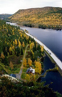
Indalsälven - view from Stadsberget , Jämtland County |
||
| Data | ||
| location | Jämtlands län , Västernorrlands län ( Sweden ) | |
| River system | Indalsälven | |
| River basin district | Bottenhavet | |
| confluence | of Åreälven and Järpströmmen 63 ° 20 '2 " N , 13 ° 26' 45" O |
|
| Source height | 378 m above sea level | |
| muzzle | at Sundsvall in the Gulf of Bothnia coordinates: 62 ° 30 '18 " N , 17 ° 26' 17" E 62 ° 30 '18 " N , 17 ° 26' 17" E |
|
| Mouth height | 0 m o.h. | |
| Height difference | 378 m | |
| Bottom slope | 0.88 ‰ | |
| length | 430 km | |
| Catchment area | 26,726.5 km² | |
| Drain |
MQ |
460 m³ / s |
| Left tributaries | Långan , Hårkan , Ammerån | |
| Flowing lakes | Storsjön | |
|
Location of the Indalsälven |
||
The Indalsälven is a river in Sweden .
Its source rivers are the Åreälven and Järpströmmen , both of which have their source in the Scandinavian Mountains northwest of Åre . The Indalsälven flows to the east, where it flows into the Gulf of Bothnia after 420 kilometers 15 km north of Sundsvall . It crosses the provinces of Jämtlands län and Västernorrlands län . Among other things, it flows through Lake Storsjön . There are numerous hydropower plants along its course.
Web links
Commons : Indalsälven - collection of images, videos and audio files
Individual evidence
- ↑ Sveriges Meteorologiska och Hydrologiska Institut (SMHI) - Län och huvudavrinningsområden i Sverige (PDF file; 2.41 MB)

