Indian Ocean Drive
| Indian Ocean Drive | |||||||||||||||||||||||||||||||
|---|---|---|---|---|---|---|---|---|---|---|---|---|---|---|---|---|---|---|---|---|---|---|---|---|---|---|---|---|---|---|---|

|
|||||||||||||||||||||||||||||||
| Basic data | |||||||||||||||||||||||||||||||
| Operator: | Main Roads | ||||||||||||||||||||||||||||||
| Start of the street: |
southeast of Lancelin ( WA ) ( 31 ° 3 ′ S , 115 ° 23 ′ E ) |
||||||||||||||||||||||||||||||
| End of street: |
south of Dongara ( WA ) ( 29 ° 28 ′ S , 115 ° 1 ′ E ) |
||||||||||||||||||||||||||||||
| Overall length: | 202 km | ||||||||||||||||||||||||||||||
|
States : |
|||||||||||||||||||||||||||||||
|
Course of the road
|
|||||||||||||||||||||||||||||||
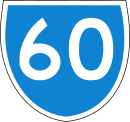
The Indian Ocean Drive is a coastal road in the southwest of the Australian state of Western Australia . It connects Lancelin Road near Lancelin with the Brand Highway south of Dongara . Since its completion (see below), the entire street has been numbered Staatsstraße 60 (S60).
history
On September 26, 2010, the last, 65 km long section from the northern suburbs of Lancelin to the old Pinnacles Desert Drive , about 10 km south of Cervantes , opened. This section of the route cost AU $ 95 million.
The new road offers travelers from Perth to Geraldton a 30-minute shorter and more scenic drive than the inland Brand Highway. However, this will continue to serve heavy traffic.
course
The Indian Ocean Drive branches off about 6 km southwest of Lancelin from the Lancelin Road to the north. At a distance of about 5 km from the coast of the Indian Ocean , it leads north to Wedge Island , about 20 km north of Lancelin. There it reaches the coast and runs right next to it to its end on the Brand Highway. It connects the coastal settlements of Cervantes, Jurien Bay, Green Head, Leeman, Coolimba and Illawong .
The two-lane road runs through several national and nature parks on the coast, such as (from south to north) the Wanagarren Nature Reserve , the Nambung National Park , the Southern Beekeepers Nature Reserve , the Drovers Cave National Park , the Lesueur National Park , Stockyard Gully National Park, and the Beekeepers Nature Reserve .
Approx. 32 km south of the coastal settlement of Dongara , the Indian Ocean Drive meets the Brand Highway and ends.
source
Steve Parish: Australian Touring Atlas . Steve Parish Publishing. Archerfield QLD 2007. ISBN 978-1-74193-232-4 . Pp. 82 + 84
Individual evidence
- ↑ Kent Scott: Indian Ocean Road to drive new boom for coastal strip . The West Australian, September 16, 2010
- ^ Indian Ocean Drive . In: Main Roads WA . Archived from the original on January 17, 2017. Info: The archive link was inserted automatically and has not yet been checked. Please check the original and archive link according to the instructions and then remove this notice. Retrieved January 17, 2017.