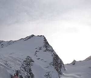
Inner black cutting
| Inner black cutting | ||
|---|---|---|
|
The northern flank of the Innere Schwarzen Schneid, from the Rettenbachferner |
||
| height | 3367 m above sea level A. | |
| location | Tyrol , Austria | |
| Mountains | Ötztal Alps | |
| Dominance | 3.7 km → Weißer Kogel | |
| Notch height | 293 m | |
| Coordinates | 46 ° 55 '26 " N , 10 ° 55' 16" E | |
|
|
||
| First ascent | 1874 by Theodor Petersen , M. Déchy, Victor Hecht with the guides Alois Ennemoser , Johann Pinggera and J. Spechtenhauser | |
The interior Schwarze Schneid (also Innere Schwarze Schneid ) is a 3367 m above sea level. A. high mountain in Tyrol in the Ötztal Alps on the Weißkamm . It is located north of the Tiefenbachkogel and east of the Linke Fernerkogel between the Rettenbachferner and Tiefenbachferner .
A ski tunnel leads through the mountain, which connects the Rettenbach and Tiefenbachferner. The summit can be reached from the mountain station of the Schwarze Schneidbahn II, which is on the north flank at 3250 m, or on a three-hour tour from the Braunschweiger Hütte .

