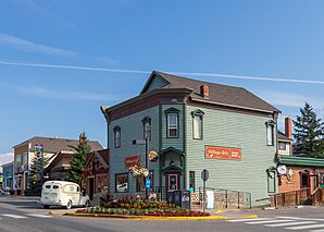
Invermere
| Invermere | ||
|---|---|---|
 Invermere |
||
| Location in British Columbia | ||
|
|
||
| State : |
|
|
| Province : | British Columbia | |
| Regional District : | East Kootenay | |
| Coordinates : | 50 ° 31 ′ N , 116 ° 2 ′ W | |
| Height : | 859 m | |
| Area : | 10.73 km² | |
| Residents : | 2955 (as of 2011) | |
| Population density : | 275.4 inhabitants / km² | |
| Time zone : | Mountain Time ( UTC − 7 ) | |
| Postal code : | V0A | |
| Mayor : | Gerry Taft | |
| Website : | www.invermere.ca | |
Invermere is a district parish in the southeast of the Canadian province of British Columbia .
location
The city is located near the Alberta border on the northwest of Lake Windermere . The main part of the actual village lies between the lake and the Columbia River . It is approximately 120 kilometers to Calgary in the northeast.
history
Invermere was established as a trading post in 1810. The place used to be called Copper City and Canterbury before it was named Invermere (after the Scottish words inver ("out of the mouth") and mere ("lake")).
Only after a long period of restrained growth did the political community Village Invermere (incorporated) be recognized on May 22, 1951 and the associated granting of local self-government . Another recognition as a District of Invermere took place on November 29, 1984.
Demographics
The census in 2011 showed a population of 2,955 inhabitants for the district municipality. The population has decreased by 1.6% compared to the 2006 census, while the population in the whole of British Columbia increased by 7% at the same time.
traffic
In north-south direction, leads on the eastern side of Lake Windermere, the Highway 93 / 95 by the district municipality. The through road Toby Creek Road connects the village with the highway. It is approximately 120 km to Calgary in the northeast.
About 2 kilometers northeast of the community is the airfield (Transport Canada Identifier: CAA8). The airfield only has a 914 meter short asphalt runway.
Furthermore, a railway line runs through the place, which leads past Dorothy Lake to the northwest .
tourism
With up to 40,000 guests on summer weekends, Invermere is the tourism center in the Columbia River valley between Golden and Cranbrook . Invermere is a tourist destination for visitors from Calgary during the summer .
Web links
Individual evidence
- ↑ http://www.travel-british-columbia.com/kootenay/thousand-peaks/invermere/ (accessed on January 7, 2017)
- ^ Origin Notes and History. Invermere. GeoBC , accessed December 2, 2012 .
- ↑ Statistics Canada (2011 Census). Invermere District Municipality Profile , accessed July 22, 2012

